
Article content
3 July 2026 by Joel Rabinowitz
Earlier this year, I was given the opportunity to take a three-month sabbatical – a chance to step away from the desk and the routines of everyday life to explore a part of the world that has long captured my imagination: South America. More specifically, I was drawn towards the continent’s southernmost frontier, which stretches like a tail towards Antarctica; carved by ancient glaciers into a labyrinth of fjords and archipelagos, and crowned by some of the most dramatic mountain peaks on Earth. To some extent, these landscapes bear a resemblance to places I’ve visited previously throughout the Nordics, but on a grander scale and with an added layer of cultural intrigue that comes from being somewhere altogether new, unfamiliar and much further from home. So, in March, my partner and I set off on a journey through Argentina and Chile, plotting a route from Tierra del Fuego and up through Patagonia, eventually culminating in the Atacama Desert.
Part one: Buenos Aires, Argentina
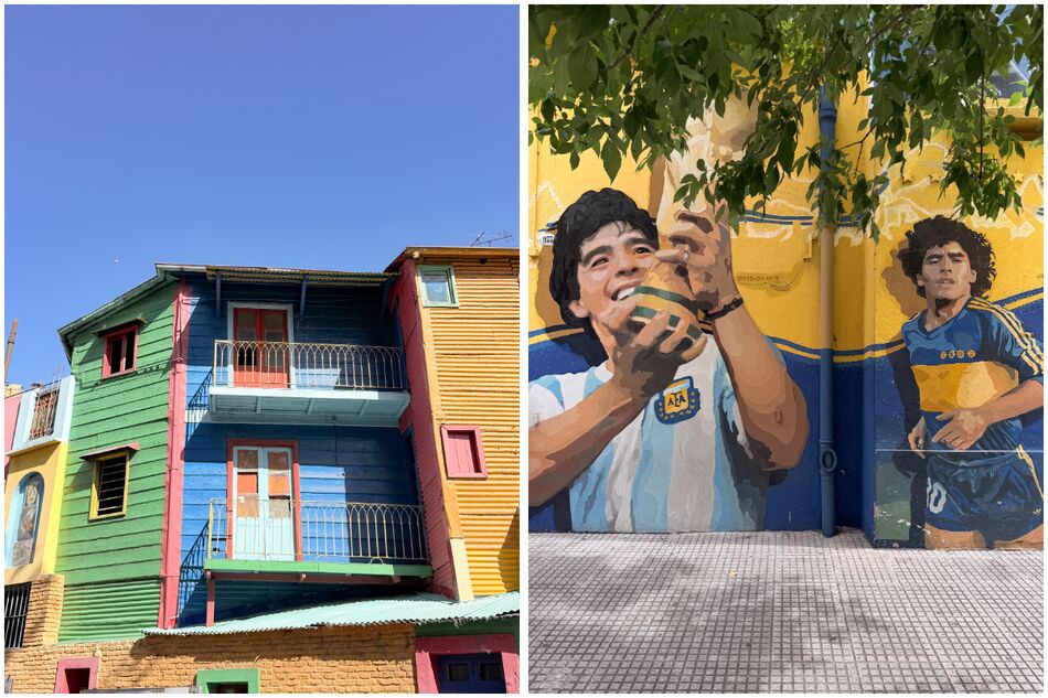
La Boca neighbourhood, Buenos Aires: Caminito (left), Diego Maradona mural (right)
As we approached Buenos Aires following a 13-and-a-half hour overnight flight from Frankfurt, I was immediately struck by the sheer scale of the city. From above, gazing out of the plane window, it appeared to stretch endlessly like a dense, concrete jungle along the shore of the Río de la Plata – the wide, muddy estuary that divides Argentina and Uruguay. The wider metropolitan area of Buenos Aires is home to more than 16 million people, which, for context, is considerably larger than the population of Greater London (9.1 million).
However, for somewhere so vast, Buenos Aires feels surprisingly manageable once you actually reach the downtown area and its immediate environs, where you’ll find the most compelling neighbourhoods and cultural attractions. We chose to base ourselves in Villa Crespo, a laid-back, mostly residential neighbourhood with an eclectic restaurant scene, just west of the main city centre. From here, it was only a short walk to Palermo, which proved to be our favourite part of Buenos Aires, with its café-strewn, tree-lined avenues, vibrant street art, beautiful parks and easy-going ambience. Indeed, you can easily spend a day or two strolling around both sides of Palermo (Soho and Hollywood) with no particular agenda.
Another neighbourhood we enjoyed exploring was San Telmo, one of the oldest areas of Buenos Aires, which simultaneously emanates a sense of faded grandeur with its crumbling colonial-era mansions and graffiti-plastered cobbled streets, coupled with a humming, bohemian energy. The leafy main square, Plaza Dorrego, hosts regular tango shows, while the historic Mercado San Telmo is a foodie haven where we devoured some of the best empanadas of the entire trip (and there was no shortage of contenders for that title).
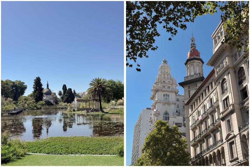
Ecoparque de Buenos Aires (left) & Palacio Barolo (right)
Just south of San Telmo lies La Boca, a historically working-class port neighbourhood which emerged in the late 19th century following an influx of Italian and Spanish immigrants. It’s a captivating, albeit very touristy area, awash with brightly-painted buildings and murals of various Argentine football icons – most notably Diego Maradona and Lionel Messi. The closer you get to La Bombonera, the home of Boca Juniors, the streets become heavily decked out in gold and blue, the club’s famous colours.
We also spent some time exploring the neighbourhoods north and west of San Telmo, namely Monserrat and San Nicolás, which are home to some of Buenos Aires’ most significant landmarks, including the Palacio Barolo, Plaza del Congreso, Teatro Colón, Plaza de Mayo and the Obelisk, which can be seen for miles around. Recoleta was another interesting area, with its lavish palaces, Parisian-style mansions, sprawling parks and the Floralis Genérica, a gleaming steel and aluminium flower sculpture.
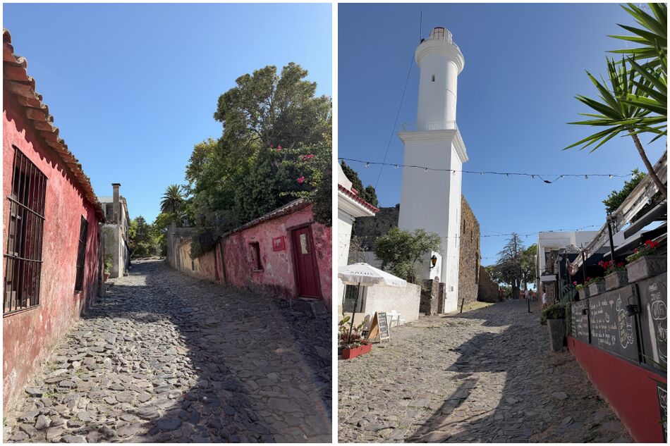
Colonia del Sacramento, Uruguay
One day, we took a short ferry (just over an hour) across the Río de la Plata to Colonia del Sacramento, the oldest town in Uruguay, which was established by the Portuguese in the late 17th century. Its UNESCO-listed historic centre was a pleasure to explore; a warren of cobbled lanes and squares lined with pastel-coloured stone houses and flourishing bougainvillea. After a good few hours of leisurely wandering, with stops for lunch and wine tasting, we waved goodbye to Colonia and took the early evening ferry back across the water to Buenos Aires. The ferry terminal is right next to the regenerated Puerto Madero docklands district, where red-brick warehouses have been converted into a plethora of upscale bars and restaurants; it reminded me of the Royal Albert Dock in Liverpool.
Soon, it was time to bid farewell to Buenos Aires and continue our journey towards the south of the country, having thoroughly enjoyed our time in the Argentine capital. After spending a full week there, I could understand why it’s often described as ‘the most European city in South America’, with certain similarities to the likes of Paris, Madrid and Barcelona – but with its own unique, multi-layered identity. It’s certainly somewhere I’d be keen to visit again.
Part two: Ushuaia, Argentina
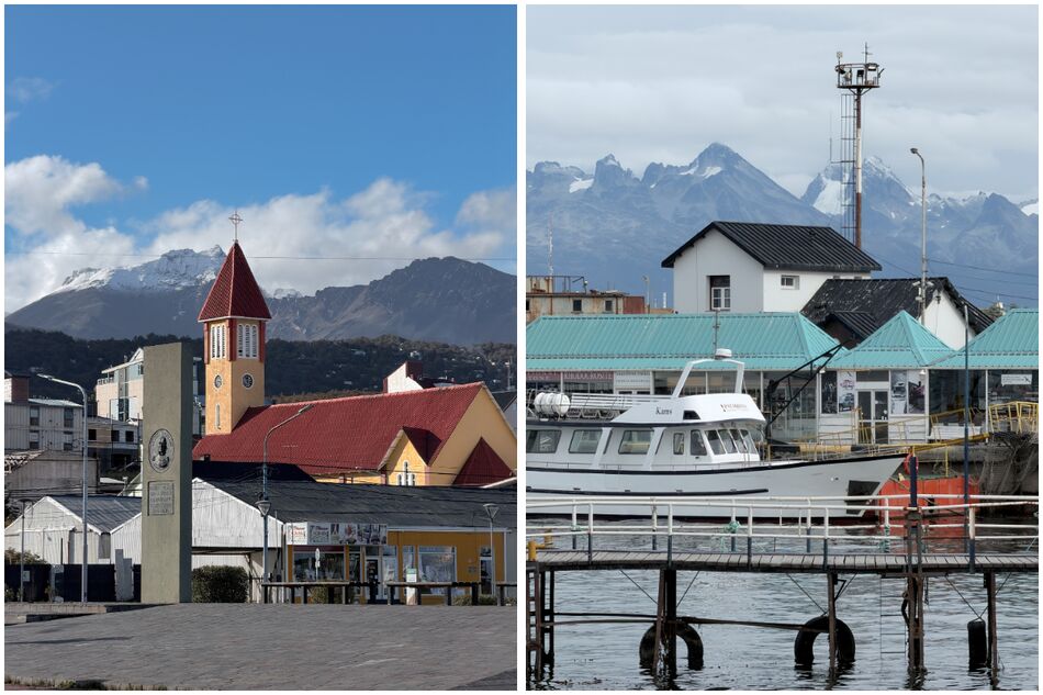
Ushuaia, Tierra del Fuego, Argentina
The next leg of our South American adventure brought us right to the southern tip of the continent, and the contrast with Buenos Aires could hardly have been more stark. Gliding over the barren, tundra-like plains and snow-crested peaks of Tierra del Fuego, it truly felt as though we had arrived at the end of the world. While the title of the world’s southernmost town is held by Puerto Williams, which lies on Chile’s Navarino Island just across the Beagle Channel, Ushuaia is the world’s southernmost fully-fledged city.
Its latitude isn’t actually that extreme (around 55° S, which is roughly equivalent to Copenhagen and Vilnius in the north), but landing in Ushuaia gave me a similar kind of feeling to the one I had when visiting Longyearbyen, the world’s northernmost town, in Norway’s Svalbard archipelago. Much like Longyearbyen, Ushuaia lies among a wild and rugged landscape of glacier-capped mountains and remote fjords, and you don’t have to venture far to find yourself in the midst of raw, pristine nature.
That wilderness frontier atmosphere is only further enhanced by the fact that Ushuaia is very much set up as the gateway to Antarctica; expedition cruises to the White Continent have become an integral part of the tourism economy here. As we arrived in late March, the final few ships of the season were departing, and while in the planning stages of our trip there was a temptation to extend our journey to reach Antarctica, we’d chosen to remain on South American soil for this particular adventure.
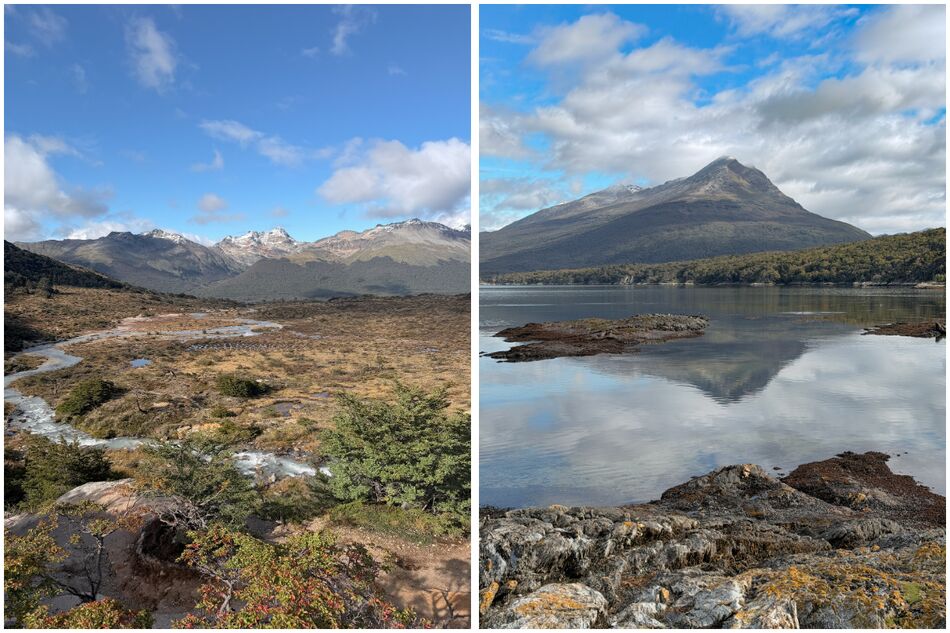
Subantarctic landscapes of Tierra del Fuego, Argentina
While Ushuaia’s setting is unquestionably spectacular, we weren’t especially enamoured by the city centre itself; it’s a hilly, scraggly sort of place, packed with souvenir shops, outdoor clothing stores and tour agencies. That said, it’s well worth taking a stroll along the waterfront promenade and stopping by the yellow Iglesia de Nuestra Señora de la Merced (the southernmost Catholic church in the world). Ushuaia’s primary appeal, however, lies in the surrounding area, which is ultimately what we were here to explore.
As expected, the weather was challenging – a mix of rain, snow, heavy winds and blue skies, often changing rapidly within a few hours – but we were able to fit in three hikes during our time here. These led us to Laguna Esmeralda (an emerald-hued glacial lake), Glacier Martial (a cirque glacier right above the city) and Tierra del Fuego National Park, where the Pan-American Highway reaches its final terminus amid a landscape of peat bogs, coastal inlets, mountains and subantarctic woodlands. This was a perfect appetiser for what was to come as we made our way north to mainland Patagonia.
Part three: Torres del Paine, Chilean Patagonia
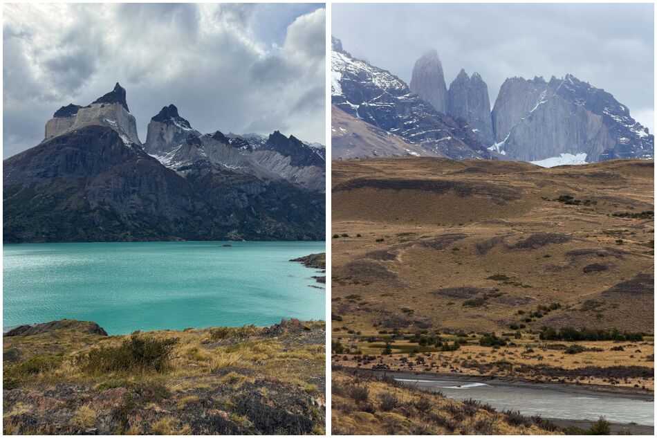
View from Mirador Cuernos (left) & Laguna Amarga checkpoint (right)
From Ushuaia, we travelled over 800 kilometres by bus, initially weaving through snow-laden mountain valleys before traversing a vast, open expanse of treeless steppe en route to the Chilean border. After crossing the Strait of Magellan – the body of water that separates Tierra del Fuego from the South American mainland – we headed deeper into Chilean Patagonia, making a brief pitstop in Punta Arenas (another gateway to Antarctica) en route to our next destination, Puerto Natales. This small, fjord-side town of colourful wood and corrugated iron buildings is the closest major tourism hub before reaching Torres del Paine – the national park that contains some of Chilean Patagonia’s most arresting scenery, around 100 kilometres to the north.
While a handful of luxury hotels, traditional lodges and camp sites can be found within the national park and close by, we opted to stay in Puerto Natales and rent a car to make day trips in and out of the park. If you’re not doing the multi-day W-trek, having your own vehicle is certainly the most flexible and convenient way of maximising your experience in Torres del Paine, as you can stop wherever you like and explore entirely at your own pace (although a note of caution – the roads in the park are very rough in parts, so flat tires are a common occurrence, as we discovered).
On our first day in Torres del Paine, we entered via the Serrano Entrance and spent the day exploring the southern and central sectors of the park. A couple of relatively short, easy hikes to Mirador Condor and Mirador Cuernos provided magnificent views of lakes Pehoé and Nordenskjöld, the French Glacier and the Cuernos del Paine – a pair of mighty, horn-shaped peaks that dominate the skyline of the Paine Massif. This was an ideal way to get an overall impression of the park’s incredibly varied landscapes, which appear even more dramatic in person than they look when captured on camera. The immense magnitude of the natural beauty on show here is both mesmerising and humbling in equal measure.
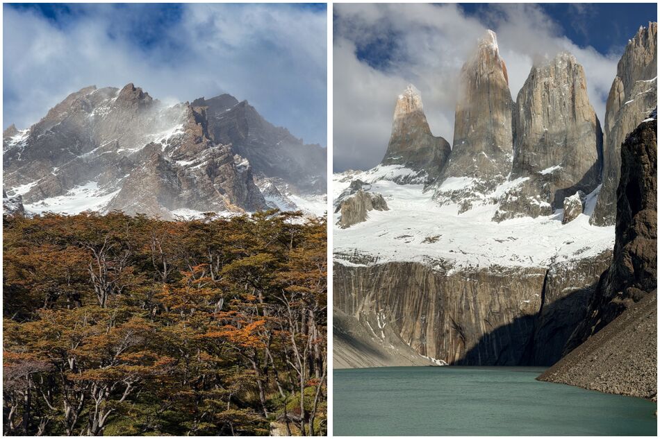
Views on the hike to Mirador Base las Torres
The next few days brought some pretty extreme conditions with ferocious winds and torrential rain, so we had to bide our time before attempting the holy grail of all Torres del Paine hikes – the trail to the base of the towers. Eventually a window of opportunity showed up in the forecast, and so we set off, in the dark, on the trail towards one of Patagonia’s most iconic sights. Despite some low clouds and drizzle along the way, we were hugely relieved to discover that the towers were visible when we reached the top of the brutal final ascent, and we spent a good hour or so soaking up the views of the three colossal granite spires that give the park its name.
Unfortunately, the weather refused to relent over the following days, meaning it wasn’t possible to return to the park for the day we’d planned to spend getting up close to Grey Glacier. Still, we left Puerto Natales on a high from completing the 24-kilometre hike to the base of the towers and brimming with anticipation for what was still to come on the Argentine side of Patagonia.
Part four: Los Glaciares National Park, Argentine Patagonia
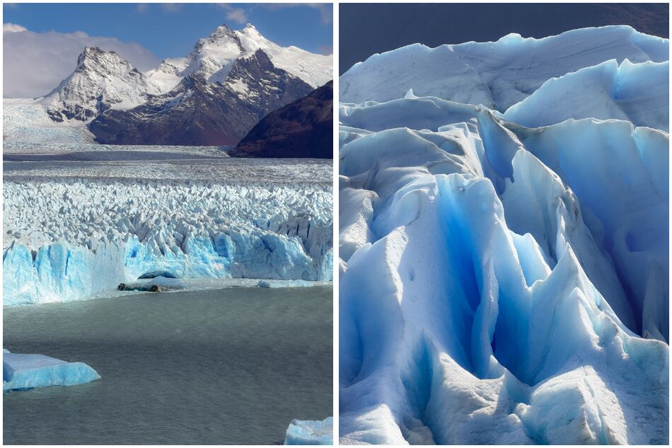
Perito Moreno Glacier
Crossing back over into Argentina, our next stop was El Calafate on the southern shore of Lago Argentino – the country’s largest lake. The town primarily serves as a launchpad for day trips to the Perito Moreno Glacier, an enormous wall of ice spilling off the eastern flank of the South Patagonia Icefield. Around five kilometres wide and up to 70 metres high at its terminus, it’s an astonishing sight to behold, and we spent several hours strolling along the extensive network of boardwalks to take it in from every possible angle.
We later returned for a second visit, taking the opportunity to join a mini-trekking tour on the glacier itself. Hiking on the glacier with crampons, you get to appreciate the glacier and its finer textures from a totally different perspective; it’s like an exceptionally intricate living organism, creaking and cracking, rippled with valleys that harbour deep blue meltwater pools, sculpturesque ice formations and gaping crevasses. Until relatively recently, Perito Moreno was one of the world’s few glaciers that remained in equilibrium, but since around 2018 it has receded rapidly; a process that is only likely to accelerate in years to come as the consequences of climate change become ever more severe.
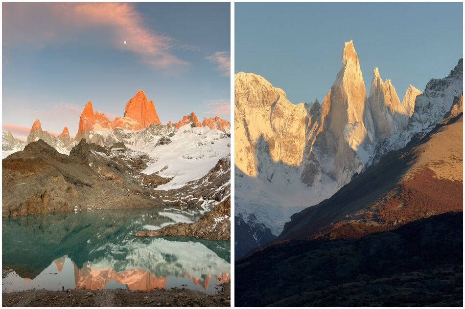
Mount Fitz Roy from Laguna de los Tres (left) & Cerro Torre at sunrise (right)
Perito Moreno is one of 47 major glaciers in Los Glaciares National Park, which extends along the Patagonian Andes towards El Chaltén – a town nestled beneath some of the region’s most distinctive peaks, including the majestic Mount Fitz Roy and its needle-shaped neighbour, Cerro Torre. Unsurprisingly, its privileged setting has earned it a reputation as the ‘Trekking Capital of Argentina’, drawing enthusiastic hikers from all around the world to explore the myriad trails that take in some of Argentine Patagonia’s most impressive viewpoints.
Chief among these is the 24-kilometre out-and-back hike to Laguna de los Tres, a glacial lake directly beneath the Fitz Roy Massif, which rises like a cathedral of jagged granite spires on the edge of the South Patagonian Icefield – right along the border between Argentina and Chile. After forensically studying the weather forecast, we were grateful to have clear conditions for this one, and having left El Chaltén at 4am, we reached Laguna de los Tres just before sunrise, as the alpenglow bathed the mountains in glorious shades of orange and pink. The final ascent up the glacial moraine was an intense physical ordeal, especially when racing against the clock, but the reward at the top was absolutely worth the early wake up and the long hike in the dark. Not only were we blessed with clear skies, but it was also a perfectly still morning, creating a mirror-like reflection of Fitz Roy on the surface of the lagoon.
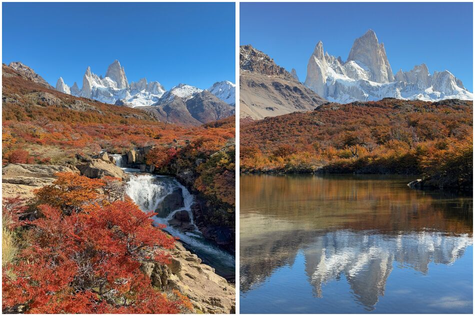
Autumn colours at Cascada Escondida (left) & Laguna Capri (right)
We completed several other exceptionally scenic hikes during our time in El Chaltén, which happened to coincide with the peak fall colours of the austral autumn. For just a few weeks, usually between late March and the first half of April, the southern beech forests of Patagonia come ablaze, thickly carpeting the valleys in earthy shades of crimson, copper and amber – a sharp contrast to the harsh greys and whites of the surrounding mountains and glaciers. On the trails to Laguna de los Tres, Laguna Torre and Loma del Pliege Tumbado in particular, we found ourselves captivated by the tapestry of colours that unfurled all around us.
For somewhere so remote, El Chaltén has a remarkable array of enticing bars and restaurants, so when you wander back into town with heavy legs and a ravenous appetite after a day on the trails, you’ll never be short of options. Pretty much everyone comes here for the same reason, which gives the place a palpable sense of common purpose and community – though it quickly begins to wind down for the season from mid-April or so. Prior to our trip, El Chaltén was right at the top of my list of the places I was most excited to visit, and after spending 10 energy-sapping but incredibly rewarding days there, I can confidently say it exceeded even the loftiest of expectations.
Part five: Isla Grande de Chiloé, Chile
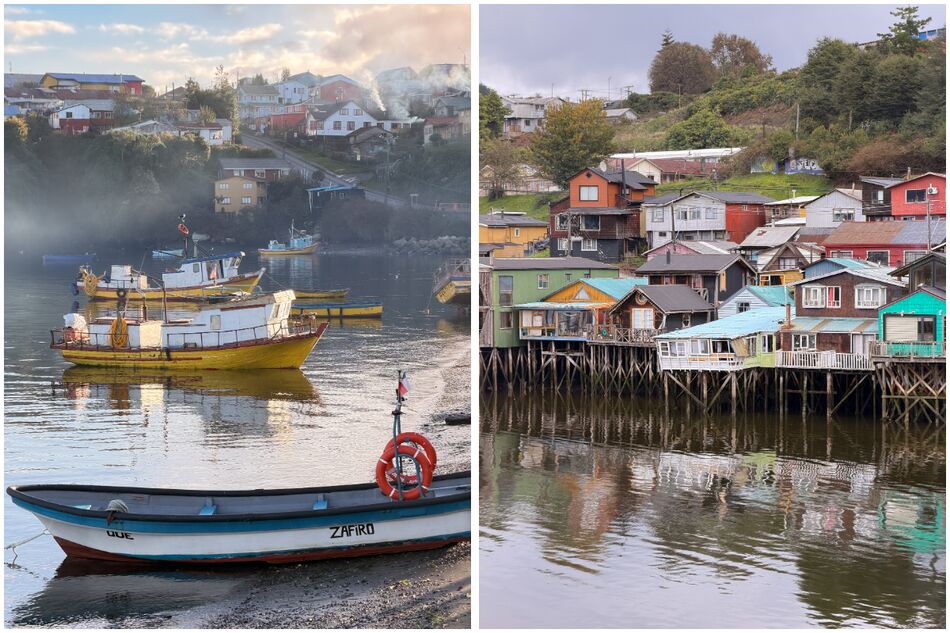
Fishing boats in Quemchi (left) & palafitos in Castro (right)
From El Chaltén, we returned via El Calafate to Puerto Natales, and took a flight to Puerto Montt, a port city that serves as the gateway to Chilean Patagonia (to the south) and the Chilean Lake District (to the north). Here, we picked up a car and set off on a road trip that involved a short ferry crossing to Isla Grande de Chiloé – the main island in the Chiloé Archipelago, which lies just off the west coast of Chile in the Pacific Ocean.
After our hiking adventures in South Patagonia, Chiloé was a perfect place to slow down and relax for a few days, staying in a secluded log cabin in a forest in the middle of the countryside. It’s a truly fascinating place, steeped in all manner of local myths and legends, with a unique culture fostered over centuries living in isolation from mainland Chile. The landscapes here were lush and green; a patchwork of temperate rainforests, farmland and gently rolling hills punctuated by small villages and colourful wooden churches. Along Chiloé’s coast, meanwhile, are wild, windswept beaches lashed by the frothing waves of the Pacific, and remote fishing communities that harvest the bounty of the archipelago’s cold, nutrient-rich waters.
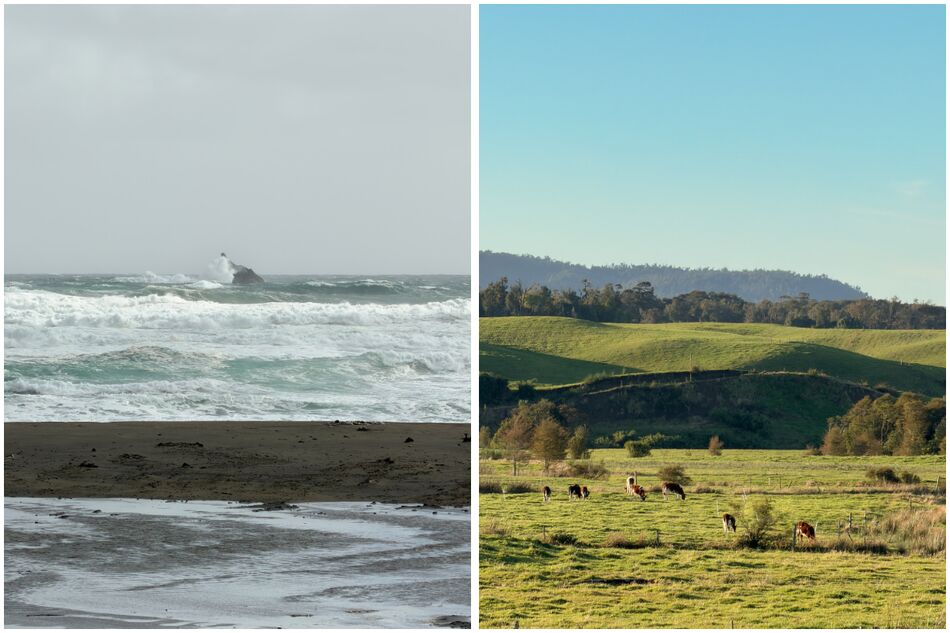
Chepu area, Isla Grande de Chiloé
Given Chiloé’s reputation for exceptional seafood, we made it our mission to seek some out, and the indoor market in Dalachue proved to be the perfect spot for a delicious lunch of local, freshly-caught salmon with papas nativas (Chiloé is said to be the original birthplace of the potato, and they grow here in many colours). There was also a temptation to try curanto – a hearty local speciality consisting of various meats, seafood and vegetables, slow-cooked in a sealed underground pit – but the portions were intimidatingly enormous, so we felt more than satisfied with our choice of dish.
Chiloé is also renowned for its brightly coloured palafitos – colourful houses built on wooden stilts above the water, the best examples of which can be found in the largest town, Castro. We also visited a couple of other coastal villages, Tenaún and Quemchi, both of which were full of character and provided an authentic taste of life in the quieter, more remote corners of the archipelago. Although the bulk of Chiloé’s amenities are concentrated in the larger towns of Castro and Ancud, we found the smaller settlements far more charming.
We encountered remarkably few tourists here – quite the contrast to Patagonia – and English was barely spoken at all, so of all the places we visited throughout our trip, Chiloé felt like the furthest off the beaten path. It’s not somewhere I’d rush back to, but I’m certainly glad we included it in our itinerary.
Part six: Lake Districts of Chile and Argentina
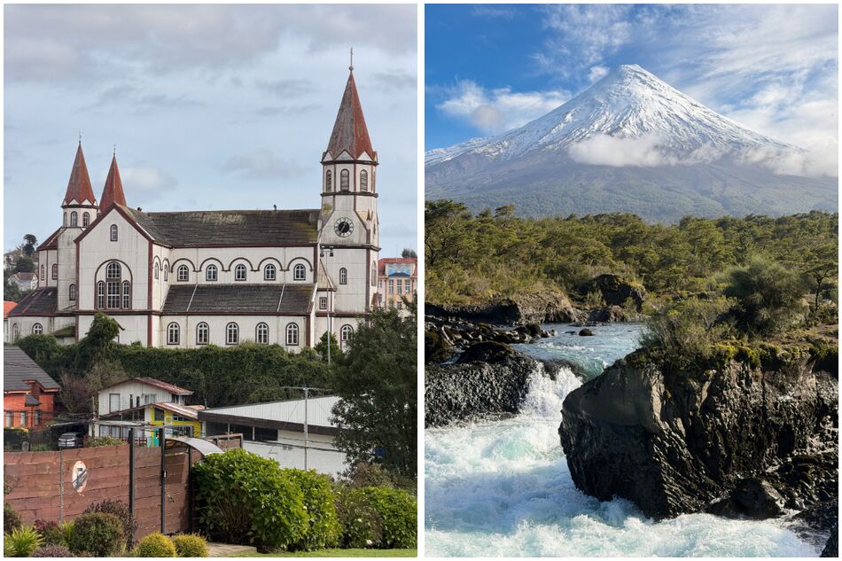
Puerto Varas (left), Saltos de Petrohué & Osorno Volcano (right)
Back on the mainland, we’d be spending the next couple of weeks exploring the Lake Districts of both Chile and Argentina, beginning on the Chilean side in Puerto Varas. It’s a particularly rainy part of the country, as moist winds blowing in from the Pacific hit the Andes and dump a huge amount of precipitation on the Chilean Lake District, while the Argentine Lake District is generally much drier. For this reason, there are swathes of temperate rainforest on the Chilean side, whereas the Argentine side has more of a mix of Andean pine forest and dry, grassy steppe.
Spread along the southern shore of Lake Llanquihue, Puerto Varas was founded by German settlers in the mid-19th century, and that heritage is firmly embedded today in the town’s architecture and cuisine. As such, you’ll find restaurants serving the likes of bratwurst, schnitzel and goulash, and lots of cafés that specialise in kaffe und kuchen (coffee and cake). There are a couple of other lovely towns along the shore of Lake Llanquihue, most notably Frutillar, which is also steeped in German heritage.
The area around Puerto Varas simmers with geothermal activity, so there are hot springs and snow-capped volcanoes in abundance. We particularly enjoyed visiting the Saltos de Petrohué – a series of rapids and waterfalls with terrific views of Osorno Volcano – as well as Termas del Sol, a relatively new geothermal spa that offers a wonderfully relaxing eight-step wellness ritual, as well as numerous hot pools of varying temperatures.
From Puerto Varas, we took a bus back across to Argentina, arriving in Bariloche, a medium-sized city in the foothills of the Andes on the shore of the vast Nahuel Huapi Lake. Whereas in Chile, the northern boundary of Patagonia is generally considered to be Puerto Montt (and therefore Patagonia doesn’t extend to the Chilean Lake District), Argentina has a broader definition, which includes Bariloche and the wider Argentine Lake District.
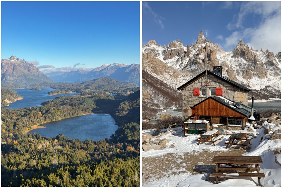
View from Cerro Campanario (left) & Refugio Frey (right)
There’s a strong Alpine influence in and around Bariloche, which is evident not just in the widespread Swiss-style chalet architecture, but also the extraordinary number of artisanal chocolate shops and microbreweries. The landscapes, too, share obvious similarities with Alpine Europe; in summer and autumn, the lakes, forests and mountains around Bariloche are a hiker’s paradise, while in winter, nearby Cerro Catedral transforms into South America’s premier ski resort.
Although not quite as dramatic as Torres del Paine and El Chaltén, the hiking here was superb and hugely varied, rivalling some of the trails we’d tackled previously in South Patagonia. Among the highlights were Cerro Campanario – a short but steep climb to one of the area’s best panoramic viewpoints – and Refugio Frey, a full-day, 20-kilometre return hike to a remote mountain refuge on the shore of a semi-frozen lake surrounded by jagged granite peaks. We also spent a day in Villa La Angostura, a smaller, alpine-style village further north on Nahuel Huapi Lake, with a peninsula covered in ancient arrayán forest.
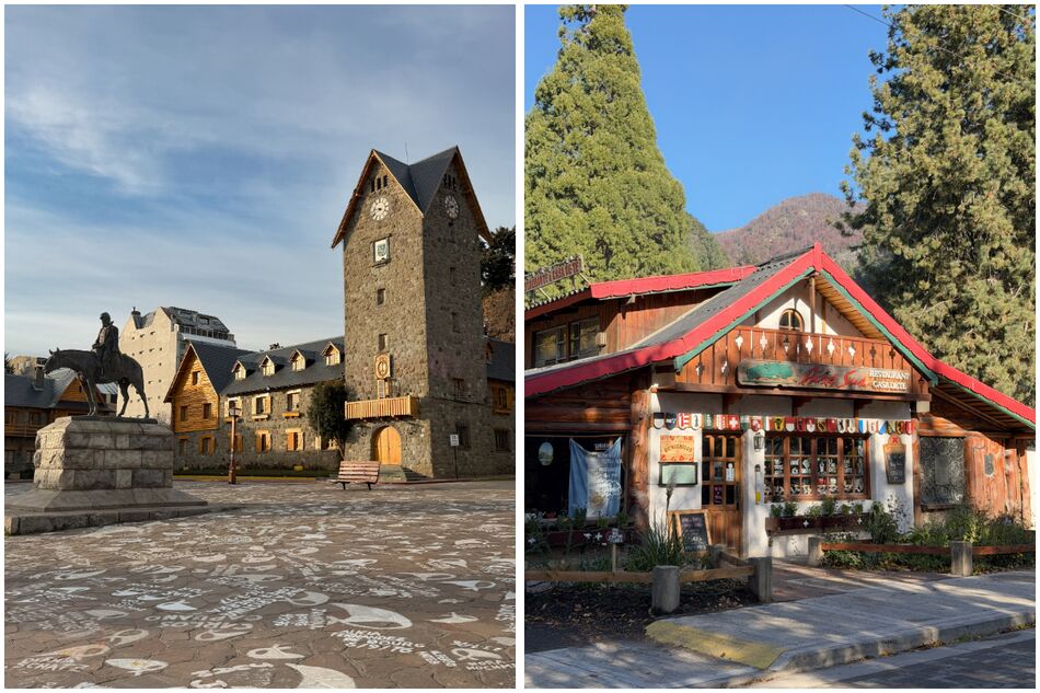
Bariloche Centro Cívico (left) & Colonia Suiza (right)
Overall, Bariloche struck me as having the best of all worlds; lots of great places to eat and drink, some interesting historic landmarks (especially the Centro Cívico and the Cathedral), and easy access to areas of outstanding natural beauty.
Our journey then continued north along the Ruta de Los Siete Lagos (Route of the Seven Lakes) to San Martín de los Andes, where we spent a couple of nights before catching a bus back across the border to our final destination in the Chilean Lake District – Pucón. While similar in many ways to Puerto Varas – an idyllic lakeside setting, volcano views, lots of nature-based activities – there was just something about the vibe of Pucón that we connected with a little more.
The views of Villarrica Volcano (akin to a mini Mount Fuji) from the town were stunning, and we enjoyed the simple pleasures of strolling along the black sand beach, sipping pisco sours by the harbour at sunset, and kayaking on Villarrica Lake. Soaking in the Termas Geométricas – a series of hot springs in a jungle-shrouded mountain canyon – was a standout experience, as was hiking among frozen lakes and native Araucaria (monkey puzzle) forests in El Cañi nature reserve.
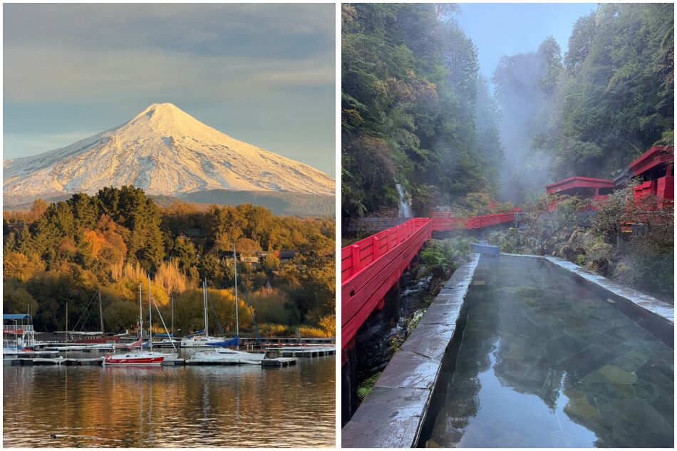
Villarrica Volcano as seen from Pucón (left) & Termas Geométricas (right)
None of Puerto Varas, Pucón or Bariloche could really be described as ‘off the beaten track’, but for some reason they do often seem to get overlooked by international travellers in favour of the more renowned ‘bucket list’ destinations in South Patagonia. It was very noticeable, for instance, that during our time exploring this region, we met significantly fewer European, Australian and North American travellers than we had in the likes of Torres del Paine and El Chaltén, and far more Chilean and Argentine holidaymakers. Part of that no doubt comes down to the fact we were visiting in May, which is well outside of peak season (roughly November – March), but I was surprised by the extent of this contrast.
The Lake Districts offer something completely different to the far south; the landscapes aren’t quite as dramatic, and you don’t get that same sense of being immersed in the wilderness, but the towns themselves are absolutely delightful and there’s an incredible variety of outdoor adventures to be had on both the Chilean and Argentine sides.
Part seven: Santiago, Chile
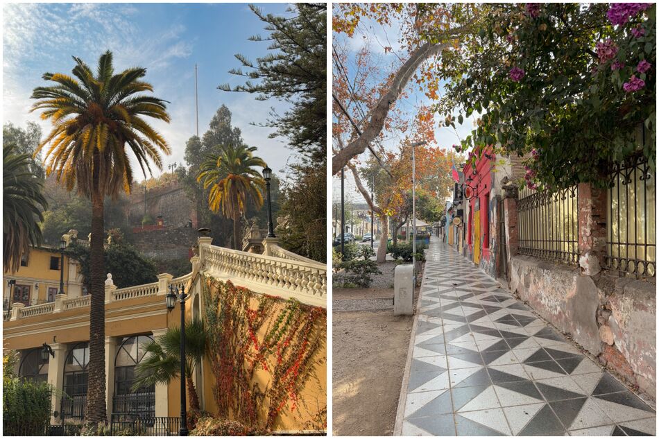
Cerro Santa Lucia (left) & Barrio Italia (right)
After a couple of months in Patagonia and the Lake Districts, arriving in Santiago – one of the largest cities in South America – felt like quite a shock to the system; the noise, the endless traffic and the thick, smoggy air were an assault on the senses at first. We were, however, pleased to be somewhere more cosmopolitan again, with the luxury of being able to find all different kinds of cuisines that had proven elusive throughout most of our trip.
Our base in Santiago was the Barrio Italia – a trendy, bohemian neighbourhood packed with interesting restaurants, artisan cafés, lively bars and boutique shops, which felt a little like a miniature version of Palermo Soho in Buenos Aires. Santiago is a vast, sprawling metropolis which can feel slightly overwhelming when you look at a map, but much like Buenos Aires, most of the major points of interest are found within a relatively manageable area.
Besides the Barrio Italia, we spent a couple of days exploring the nearby neighbourhoods of Lastarria, Providencia and Bellavista, as well as the Centro Histórico, which contains major landmarks including the enormous, palm-speckled main square, Plaza de Armas. Whereas parts of Santiago feel very historic, with grand palaces, mansions, ornate fountains and cobbled streets, others (especially the eastern side of Providencia and Las Condes) are full of gleaming skyscrapers (including Gran Torre, the tallest building in South America), luxury hotels and glitzy shopping malls; it’s a city of striking contrasts.
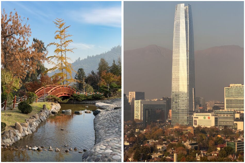
Japanese Garden (left) & Gran Torre as seen from San Cristóbal Hill (right)
A distinctive aspect of Santiago’s geography is the presence of several prominent hills that punctuate the largely flat basin in which it sits, providing easily accessible pockets of nature within easy reach of the downtown area. Among these are Cerro Santa Lucia, which rises between Lastarria and the Centro Histórico, and Cerro San Cristóbal, which rises from the northern banks of the Mapocho River and contains a gorgeous Japanese garden. Cerro Santa Lucia is a beautifully landscaped urban park which you can easily walk up, while Cerro San Cristóbal requires a longer hike – or a cable car or funicular ride – to reach the top. Both hills are well worth visiting and provide sweeping views over Santiago, though the impressive Andean backdrop is unfortunately often shrouded by a hazy smog.
Both prior to and during our trip, I’d read and heard plenty that described Santiago in not especially flattering terms, so I arrived with an open mind but somewhat limited expectations. I was, however, pleasantly surprised by what the Chilean capital had to offer, and it proved to be a thoroughly worthwhile stop before embarking on the final leg of our adventure.
Part eight: San Pedro de Atacama, Chile
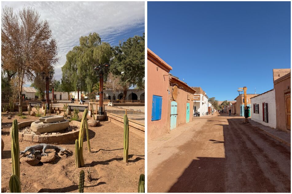
Plaza de Armas (left) & Caracoles street (right), San Pedro de Atacama
After a fun few days in Santiago, we caught a flight north to Calama, a dusty copper mining town in the exceptionally arid Antofagasta region of Chile. Landing here felt like arriving on another planet; outside the plane window, a scorched, lunar-like landscape of rust-red plains and undulating sand dunes stretched towards the horizon. For the next week, we stayed in San Pedro de Atacama, the gateway to the Atacama Desert – the driest non-polar desert on Earth. The natural barriers of the Andes (to the east) and the Chilean Coast Range (to the west) create a ‘double rain shadow’ effect, preventing moist air from reaching the Atacama Desert; as such, some weather stations in the area have never recorded a single drop of rain.
San Pedro itself is a buzzy little oasis town with plenty of character. Granted, it’s a little swamped by tour agencies along the main street (Caracoles), but the prevalence of adobe (mud brick) low-rise buildings creates an earthy aesthetic that fits perfectly with the natural surroundings. Just off Caracoles lies the atmospheric main square, Plaza de Armas, which is dotted with pepper trees and cacti and flanked by the whitewashed, colonial-era Iglesia de San Pedro. As a base for exploring the Atacama Desert, San Pedro has everything you need, including an extensive range of hotels to suit all budgets and, as we discovered, some truly excellent restaurants – most notably Adobe and Rincón de Sal.
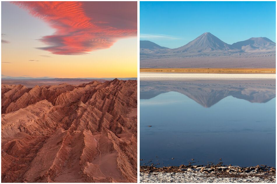
Valle de la Luna (left) & Laguna Tebinquiche (right)
We had deliberated over the idea of renting a car, but ultimately opted for the convenience and conviviality of joining several small-group organised tours to explore the natural wonders of the surrounding region. The first of these led us to a series of lagoons on the Salar de Atacama, the largest salt flat in Chile, including one (Laguna Piedra) where we could take a dip and float effortlessly in the salty water. Another nearby lagoon, Tebinquiche, stretched out in front of us like a sheet of glass, creating a mirror effect much like that of the famous Uyuni Salt Flat in neighbouring Bolivia.
Our next tour focused on the Valle de la Luna (Valley of the Moon), where we explored a rugged landscape of dunes, craters, ridges and rock formations sculpted by the wind and sand. The sunset here transfixed us, as the valley was cast in a deep, golden glow, while the wispy clouds above burned tangerine-pink against the gently dimming sky. Later that same day, once darkness set in, we spent the evening at a dark sky location just outside of San Pedro, where we could vividly see the Milky Way with the naked eye and view planets, constellations and nebulae in extraordinary detail using powerful telescopes. Owing to the absence of artificial light pollution, the Atacama Desert lies beneath some of the darkest skies on Earth, making it a prime destination to observe the wonders of the universe.
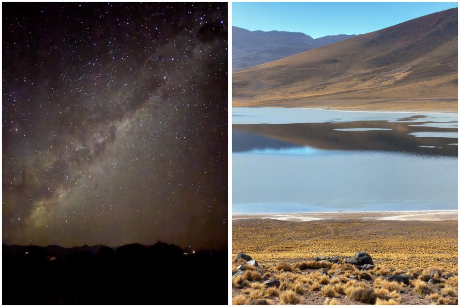
Milky Way (left) & Laguna Miscanti (right)
On our final adventure, we ascended to the Altiplano – the high-altitude plateau that extends across northern Chile, southwestern Bolivia, northwestern Argentina and southern Peru – to visit several Andean lagoons and the Piedras Rojas, a surreal expanse of copper-red rocks at 4,200 metres above sea level. At this elevation, the environment was a total contrast to the sun-baked, salt-encrusted basin down below; much richer in flora, dominated by puna grasslands and hardy shrubs. We spotted a rich variety of wildlife on this particular outing, including vicuñas, rheas (a flightless, ostrich-like bird), and numerous species of flamingos at Laguna Chaxa on our way back to San Pedro.
In addition to our guided tours, we also rented bikes on a couple of occasions to explore the Valle de la Muerte (Death Valley) and Garganta del Diablo (Devil's Throat) just outside of San Pedro, both of which I'd highly recommend.
Having spent the majority of our time in Patagonia and the Lake Districts of Chile and Argentina, we could hardly have picked somewhere more different than the Atacama Desert to spend the final week of our South American journey. And, in close competition with El Chaltén and Torres del Paine, it ranked among the most memorable stops of the entire trip.
Closing thoughts
From the subantarctic wilds of Tierra del Fuego and South Patagonia to the alpine delights of the Lake Districts and the otherworldly splendour of the Atacama Desert, our journey through Argentina and Chile covered an astonishing range of awe-inspiring landscapes that together encapsulate the geographical diversity of these two endlessly captivating countries. Both capital cities, meanwhile, offered a fascinating blend of history, culture and cuisine to neatly bookend our trip – though Buenos Aires made the greater impression of the two.
Over the course of just less than three months, we travelled over 5,000 kilometres by plane, bus, car and ferry, exploring several regions fairly comprehensively – and yet, I still feel as though we only scratched the surface, as both countries boast such a staggering wealth of natural wonders and cultural riches. Had time allowed, I would’ve loved to explore Chile’s Carretera Austral, for instance, or flown out to Easter Island. Likewise in Argentina, we didn’t make it to Iguazu Falls, Mendoza or Salta, all of which, I’m sure, would’ve been worthy additions to our itinerary.
As a first proper foray to this part of the world, however, I couldn’t have asked for a better experience – and it’s given me all the inspiration I need to come back for more.


