
Summary
Itinerary & Map
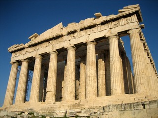
It's no wonder that all roads lead to the fascinating and maddening metropolis of Athens. Lift your eyes 200 feet above the city to the Parthenon, its honey-col...
Full description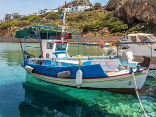
Syros is an island in the Aegean Sea, 78 miles (125 kilometres) southeast of Athens, and the administrative, commercial, intellectual and cultural centre of the...
Full description
For better or worse, it can be difficult to reach Patmos—for many travelers, this lack of access is definitely for the better, since the island retains the air...
Full description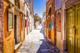
Undoubtedly the most extraordinary island in the Aegean, crescent-shape Santorini remains a mandatory stop on the Cycladic tourist route—even if it's necessary...
Full description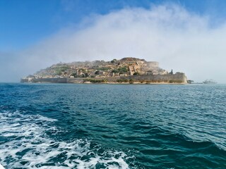
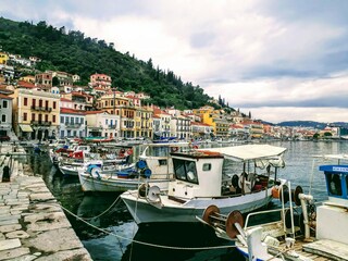
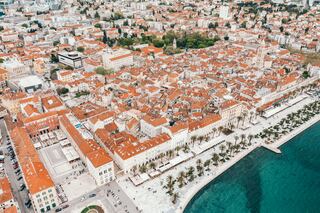
Split's ancient core is so spectacular and unusual that a visit is more than worth your time. The heart of the city lies within the walls of Roman emperor Diocl...
Full description
The Croatian island of Hvar bills itself as the "sunniest island in the Adriatic." Not only does it have the figures to back up this claim—an annual average of...
Full description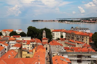
Dalmatia's capital for more than 1,000 years, Zadar is all too often passed over by travelers on their way to Split or Dubrovnik. What they miss out on is a cit...
Full description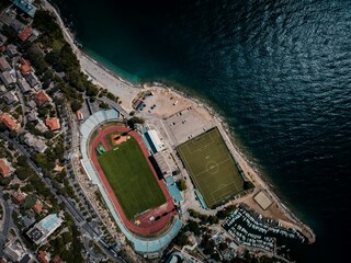
Water is the essence of Kvarner, and the region's largest city expresses this simply. Whether in Croatian or Italian (Fiume) the translation of the name to Engl...
Full description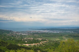
Today a port town surrounded by industrial suburbs, Koper nevertheless warrants a visit. The Republic of Venice made Koper the regional capital during the 15th...
Full description
It's no wonder that all roads lead to the fascinating and maddening metropolis of Athens. Lift your eyes 200 feet above the city to the Parthenon, its honey-col...
Full description
Syros is an island in the Aegean Sea, 78 miles (125 kilometres) southeast of Athens, and the administrative, commercial, intellectual and cultural centre of the...
Full description
For better or worse, it can be difficult to reach Patmos—for many travelers, this lack of access is definitely for the better, since the island retains the air...
Full description
Undoubtedly the most extraordinary island in the Aegean, crescent-shape Santorini remains a mandatory stop on the Cycladic tourist route—even if it's necessary...
Full description
Split's ancient core is so spectacular and unusual that a visit is more than worth your time. The heart of the city lies within the walls of Roman emperor Diocl...
Full description
The Croatian island of Hvar bills itself as the "sunniest island in the Adriatic." Not only does it have the figures to back up this claim—an annual average of...
Full description
Dalmatia's capital for more than 1,000 years, Zadar is all too often passed over by travelers on their way to Split or Dubrovnik. What they miss out on is a cit...
Full description
Water is the essence of Kvarner, and the region's largest city expresses this simply. Whether in Croatian or Italian (Fiume) the translation of the name to Engl...
Full description
Today a port town surrounded by industrial suburbs, Koper nevertheless warrants a visit. The Republic of Venice made Koper the regional capital during the 15th...
Full description
Piraeus
It's no wonder that all roads lead to the fascinating and maddening metropolis of Athens. Lift your eyes 200 feet above the city to the Parthenon, its honey-color marble columns rising from a massive limestone base, and you behold architectural perfection that has not been surpassed in 2,500 years. But, today, this shrine of classical form dominates a 21st-century boomtown. To experience Athens—Athína in Greek—fully is to understand the essence of Greece: ancient monuments surviving in a sea of cement, startling beauty amid the squalor, tradition juxtaposed with modernity. Locals depend on humor and flexibility to deal with the chaos; you should do the same. The rewards are immense. Although Athens covers a huge area, the major landmarks of the ancient Greek, Roman, and Byzantine periods are close to the modern city center. You can easily walk from the Acropolis to many other key sites, taking time to browse in shops and relax in cafés and tavernas along the way. From many quarters of the city you can glimpse "the glory that was Greece" in the form of the Acropolis looming above the horizon, but only by actually climbing that rocky precipice can you feel the impact of the ancient settlement. The Acropolis and Filopappou, two craggy hills sitting side by side; the ancient Agora (marketplace); and Kerameikos, the first cemetery, form the core of ancient and Roman Athens. Along the Unification of Archaeological Sites promenade, you can follow stone-paved, tree-lined walkways from site to site, undisturbed by traffic. Cars have also been banned or reduced in other streets in the historical center. In the National Archaeological Museum, vast numbers of artifacts illustrate the many millennia of Greek civilization; smaller museums such as the Goulandris Museum of Cycladic Art Museum and the Byzantine and Christian Museum illuminate the history of particular regions or periods. Athens may seem like one huge city, but it is really a conglomeration of neighborhoods with distinctive characters. The Eastern influences that prevailed during the 400-year rule of the Ottoman Empire are still evident in Monastiraki, the bazaar area near the foot of the Acropolis. On the northern slope of the Acropolis, stroll through Plaka (if possible by moonlight), an area of tranquil streets lined with renovated mansions, to get the flavor of the 19th-century's gracious lifestyle. The narrow lanes of Anafiotika, a section of Plaka, thread past tiny churches and small, color-washed houses with wooden upper stories, recalling a Cycladic island village. In this maze of winding streets, vestiges of the older city are everywhere: crumbling stairways lined with festive tavernas; dank cellars filled with wine vats; occasionally a court or diminutive garden, enclosed within high walls and filled with magnolia trees and the flaming trumpet-shaped flowers of hibiscus bushes. Formerly run-down old quarters, such as Thission, Gazi and Psirri, popular nightlife areas filled with bars and mezedopoleia (similar to tapas bars), are now in the process of gentrification, although they still retain much of their original charm, as does the colorful produce and meat market on Athinas. The area around Syntagma Square, the tourist hub, and Omonia Square, the commercial heart of the city about 1 km (½ mi) northwest, is distinctly European, having been designed by the court architects of King Otho, a Bavarian, in the 19th century. The chic shops and bistros of ritzy Kolonaki nestle at the foot of Mt. Lycabettus, Athens's highest hill (909 feet). Each of Athens's outlying suburbs has a distinctive character: in the north is wealthy, tree-lined Kifissia, once a summer resort for aristocratic Athenians, and in the south and southeast lie Glyfada, Voula, and Vouliagmeni, with their sandy beaches, seaside bars, and lively summer nightlife. Just beyond the city's southern fringes is Piraeus, a bustling port city of waterside fish tavernas and Saronic Gulf views.
Ermoupoli, Syra
Syros is an island in the Aegean Sea, 78 miles (125 kilometres) southeast of Athens, and the administrative, commercial, intellectual and cultural centre of the Cyclades. Syros is 32 square miles (82.8 square kilometres) in area. Its largest towns are Ermoupoli, the capital of the island and Cyclades, Ano Syros and Vari. Although Syros belongs to the Cyclades islands, its architecture is more medieval than Cycladic. The beaches of Syros are especially inviting, and surrounded by many tourist facilities and accommodations.
Pátmos
For better or worse, it can be difficult to reach Patmos—for many travelers, this lack of access is definitely for the better, since the island retains the air of an unspoiled retreat. Rocky and barren, the small, 34-square-km (21-square-mi) island lies beyond the islands of Kalymnos and Leros, northwest of Kos. Here on a hillside is the Monastery of the Apocalypse, which enshrines the cave where St. John received the Revelation in AD 95. Scattered evidence of Mycenaean presence remains on Patmos, and walls of the classical period indicate the existence of a town near Skala. Most of the island's approximately 2,800 people live in three villages: Skala, medieval Chora, and the small rural settlement of Kambos. The island is popular among the faithful making pilgrimages to the monastery as well as with vacationing Athenians and a newly growing community of international trendsetters—designers, artists, poets, and “taste gurus” (to quote Vogue’s July 2011 write-up of the island)—who have bought homes in Chora. These stylemeisters followed in the footsteps of Alexandrian John Stefanidis and the English artist Teddy Millington-Drake who, in the early ’60s, set about creating what eventually became hailed as one of the most gorgeous island homes in the world. The word soon spread thanks to their many guests (who included Jacqueline Kennedy Onassis) but, happily, administrators have carefully contained development, and as a result, Patmos retains its charm and natural beauty—even in the busy month of August.
Santorini
Undoubtedly the most extraordinary island in the Aegean, crescent-shape Santorini remains a mandatory stop on the Cycladic tourist route—even if it's necessary to enjoy the sensational sunsets from Ia, the fascinating excavations, and the dazzling white towns with a million other travelers. Called Kállisti (the "Loveliest") when first settled, the island has now reverted to its subsequent name of Thira, after the 9th-century-BC Dorian colonizer Thiras. The place is better known, however, these days as Santorini, a name derived from its patroness, St. Irene of Thessaloniki, the Byzantine empress who restored icons to Orthodoxy and died in 802. You can fly conveniently to Santorini, but to enjoy a true Santorini rite of passage, opt instead for the boat trip here, which provides a spectacular introduction. After the boat sails between Sikinos and Ios, your deck-side perch approaches two close islands with a passage between them. The bigger one on the left is Santorini, and the smaller on the right is Thirassia. Passing between them, you see the village of Ia adorning Santorini's northernmost cliff like a white geometric beehive. You are in the caldera (volcanic crater), one of the world's truly breathtaking sights: a demilune of cliffs rising 1,100 feet, with the white clusters of the towns of Fira and Ia perched along the top. The bay, once the high center of the island, is 1,300 feet in some places, so deep that when boats dock in Santorini's shabby little port of Athinios, they do not drop anchor. The encircling cliffs are the ancient rim of a still-active volcano, and you are sailing east across its flooded caldera. On your right are the Burnt isles, the White isle, and other volcanic remnants, all lined up as if some outsize display in a geology museum. Hephaestus's subterranean fires smolder still—the volcano erupted in 198 BC, about 735, and there was an earthquake in 1956. Indeed, Santorini and its four neighboring islets are the fragmentary remains of a larger landmass that exploded about 1600 BC: the volcano's core blew sky high, and the sea rushed into the abyss to create the great bay, which measures 10 km by 7 km (6 mi by 4½ mi) and is 1,292 feet deep. The other pieces of the rim, which broke off in later eruptions, are Thirassia, where a few hundred people live, and deserted little Aspronissi ("White isle"). In the center of the bay, black and uninhabited, two cones, the Burnt Isles of Palea Kameni and Nea Kameni, appeared between 1573 and 1925. There has been too much speculation about the identification of Santorini with the mythical Atlantis, mentioned in Egyptian papyri and by Plato (who says it's in the Atlantic), but myths are hard to pin down. This is not true of old arguments about whether tidal waves from Santorini's cataclysmic explosion destroyed Minoan civilization on Crete, 113 km (70 mi) away. The latest carbon-dating evidence, which points to a few years before 1600 BC for the eruption, clearly indicates that the Minoans outlasted the eruption by a couple of hundred years, but most probably in a weakened state. In fact, the island still endures hardships: since antiquity, Santorini has depended on rain collected in cisterns for drinking and irrigating—the well water is often brackish—and the serious shortage is alleviated by the importation of water. However, the volcanic soil also yields riches: small, intense tomatoes with tough skins used for tomato paste (good restaurants here serve them); the famous Santorini fava beans, which have a light, fresh taste; barley; wheat; and white-skin eggplants.
Split
Split's ancient core is so spectacular and unusual that a visit is more than worth your time. The heart of the city lies within the walls of Roman emperor Diocletian's retirement palace, which was built in the 3rd century AD. Diocletian, born in the nearby Roman settlement of Salona in AD 245, achieved a brilliant career as a soldier and became emperor at the age of 40. In 295 he ordered this vast palace to be built in his native Dalmatia, and when it was completed he stepped down from the throne and retired to his beloved homeland. Upon his death, he was laid to rest in an octagonal mausoleum, around which Split's magnificent cathedral was built.In 615, when Salona was sacked by barbarian tribes, those fortunate enough to escape found refuge within the stout palace walls and divided up the vast imperial apartments into more modest living quarters. Thus, the palace developed into an urban center, and by the 11th century the settlement had expanded beyond the ancient walls.Under the rule of Venice (1420–1797), Split—as a gateway to the Balkan interior—became one of the Adriatic's main trading ports, and the city's splendid Renaissance palaces bear witness to the affluence of those times. When the Habsburgs took control during the 19th century, an overland connection to Central Europe was established by the construction of the Split–Zagreb–Vienna railway line.After World War II, the Tito years saw a period of rapid urban expansion: industrialization accelerated and the suburbs extended to accommodate high-rise apartment blocks. Today the historic center of Split is included on UNESCO's list of World Heritage Sites.
Hvar Island
The Croatian island of Hvar bills itself as the "sunniest island in the Adriatic." Not only does it have the figures to back up this claim—an annual average of 2,724 hours of sunshine—but it also makes visitors a sporting proposition, offering them a money-back guarantee if there are seven consecutive days of snow (snow has been known to fall here; the last time being February 2012).
Zadar
Dalmatia's capital for more than 1,000 years, Zadar is all too often passed over by travelers on their way to Split or Dubrovnik. What they miss out on is a city of more than 73,000 that is remarkably lovely and lively despite—and, in some measure, because of—its tumultuous history. The Old Town, separated from the rest of the city on a peninsula some 4 km (2½ miles) long and just 1,640 feet wide, is bustling and beautiful: the marble pedestrian streets are replete with Roman ruins, medieval churches, palaces, museums, archives, and libraries. Parts of the new town are comparatively dreary, a testament to what a world war followed by decades of communism, not to mention a civil war, can do to the architecture of a city that is 3,000 years old. A settlement had already existed on the site of the present-day city for some 2,000 years when Rome finally conquered Zadar in the 1st century BC; the foundations of the forum can be seen today. Before the Romans came the Liburnians had made it a key center for trade with the Greeks and Romans for 800 years. In the 3rd century BC the Romans began to seriously pester the Liburnians, but required two centuries to bring the area under their control. During the Byzantine era, Zadar became the capital of Dalmatia, and this period saw the construction of its most famous church, the 9th-century St. Donat's Basilica. It remained the region's foremost city through the ensuing centuries. The city then experienced successive onslaughts and occupations—both long and short—by the Osogoths, the Croatian-Hungarian kings, the Venetians, the Turks, the Habsburgs, the French, the Habsburgs again, and finally the Italians before becoming part of Yugoslavia and, in 1991, the independent republic of Croatia. Zadar was for centuries an Italian-speaking city, and Italian is still spoken widely, especially by older people. Indeed, it was ceded to Italy in 1921 under the Treaty of Rapallo (and reverted to its Italian name of Zara). Its occupation by the Germans from 1943 led to intense bombing by the Allies during World War II, which left most of the city in ruins. Zadar became part of Tito's Yugoslavia in 1947, prompting many Italian residents to leave. Zadar's most recent ravages occurred during a three-month siege by Serb forces and months more of bombardment during the Croatian-Serbian war between 1991 and 1995. But you'd be hard-pressed to find outward signs of this today in what is a city to behold. There are helpful interpretive signs in English all around the Old Town, so you certainly won't feel lost when trying to make sense of the wide variety of architectural sites you might otherwise pass by with only a cursory look.
Rijeka
Water is the essence of Kvarner, and the region's largest city expresses this simply. Whether in Croatian or Italian (Fiume) the translation of the name to English is the same: river. Although the history of Croatia's third city goes back to the days of Imperial Rome, modern Rijeka evolved under the rule of Austria-Hungary. The historic core retains vestiges of the old Habsburg monarchy from the time when Rijeka served as the empire's outlet to the Adriatic. During the 1960s, under Yugoslavia, the suburbs expanded rapidly. Rijeka is the country's largest port, with a huge shipyard, massive dry-dock facilities, refineries, and other heavy industries offering large-scale employment. Since the breakup of Yugoslavia, however, Rijeka's role as a shipping town has declined significantly. Much business shifted north to the smaller Slovene ports during the crippling wars of the 1990s, and although some has returned, the volume remains less than half that seen in 1980.
Koper
Today a port town surrounded by industrial suburbs, Koper nevertheless warrants a visit. The Republic of Venice made Koper the regional capital during the 15th and 16th centuries, and the magnificent architecture of the Old Town bears witness to the spirit of those times.The most important buildings are clustered around Titov trg, the central town square. Here stands the Cathedral, which can be visited daily from 7 to noon and 3 to 7, with its fine Venetian Gothic facade and bell tower dating back to 1664. Across the square the splendid Praetor's Palace, formerly the seat of the Venetian Grand Council, combines Gothic and Renaissance styles. From the west side of Titov trg, the narrow, cobbled Kidriceva ulica brings you down to the seafront.
Dates & prices
Select guest
Departs
Thu 5 Oct 2028
Silver Dawn
from £6,600 pp
Enquire now Call 020 7590 0610Per person, based on two sharing, cruise only. Updated daily and confirmed when you book.