
Summary
Begin your Discovery Voyage, from Timaru to Lautoka, tracing New Zealand’s characterful shores from Akaroa’s French-accented harbour and the Marlborough Sounds to Napier’s Art Deco avenues and the sheltered coves of the Bay of Islands. Continue via Norfolk Island’s striking headlands to Fiji’s Yasawa Islands, where clear lagoons, coral gardens and vibrant marine life reveal a gentler rhythm of the South Pacific.
Begin your Discovery Voyage, from Timaru to Lautoka, tracing New Zealand’s characterful shores from Akaroa’s French-accented harbour and the Marlborough Sounds to Napier’s Art Deco avenues and the sheltered coves of the Bay of Islands. Continue via Norfolk Island’s striking headlands to Fiji’s Yasawa Islands, where clear lagoons, coral gardens and vibrant marine life reveal a gentler rhythm of the South Pacific.
Itinerary & Map
Christchurch is one of New Zealand’s most English cities. The Anglisation of the area is quickly evident throughout. The name Christchurch, is named after one o...
Full description
The maritime township of Picton (population 4,000) lies at the head of Queen Charlotte Sound and is the arrival point for ferries from the North Island, as well...
Full description
The earthquake that struck Napier at 10:46 am on February 3, 1931, was—at 7.8 on the Richter scale—the largest quake ever recorded in New Zealand. The coastline...
Full description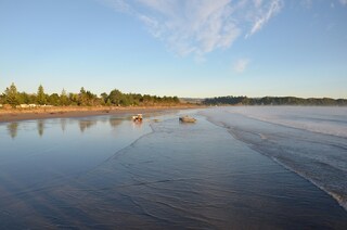
With a population of around 35,000 and located on the north island, Gisborne exudes history at every turn. Maori for “Great standing place of Kiwa”, Kiwa was a...
Full description
The population center of the Bay of Plenty, Tauranga is one of New Zealand's fastest-growing cities. Along with its neighbor, Whakatane, this seaside city claim...
Full description
The Tasman Sea on the west and the Pacific Ocean on the east meet at thetop of North Island at Cape Reinga. No matter what route you take, you'll passfarms and...
Full description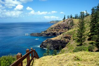
North of Nadi through sugarcane plantations and past the Sabeto Mountains is Lautoka, nicknamed the Sugar City for the local agriculture and its big processing...
Full description
Christchurch is one of New Zealand’s most English cities. The Anglisation of the area is quickly evident throughout. The name Christchurch, is named after one o...
Full description
The maritime township of Picton (population 4,000) lies at the head of Queen Charlotte Sound and is the arrival point for ferries from the North Island, as well...
Full description
The earthquake that struck Napier at 10:46 am on February 3, 1931, was—at 7.8 on the Richter scale—the largest quake ever recorded in New Zealand. The coastline...
Full description
With a population of around 35,000 and located on the north island, Gisborne exudes history at every turn. Maori for “Great standing place of Kiwa”, Kiwa was a...
Full description
The population center of the Bay of Plenty, Tauranga is one of New Zealand's fastest-growing cities. Along with its neighbor, Whakatane, this seaside city claim...
Full description
The Tasman Sea on the west and the Pacific Ocean on the east meet at thetop of North Island at Cape Reinga. No matter what route you take, you'll passfarms and...
Full description
North of Nadi through sugarcane plantations and past the Sabeto Mountains is Lautoka, nicknamed the Sugar City for the local agriculture and its big processing...
Full descriptionTimaru (Christchurch), New Zealand
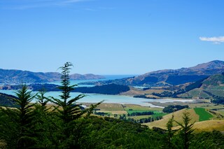
Christchurch is one of New Zealand’s most English cities. The Anglisation of the area is quickly evident throughout. The name Christchurch, is named after one of the most famous Oxford Colleges. Traditional English styled punts can be seen drifting lazily along the Avon River, and customary striped blazers are still worn by students at Christ’s College.
Picton, New Zealand
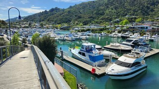
The maritime township of Picton (population 4,000) lies at the head of Queen Charlotte Sound and is the arrival point for ferries from the North Island, as well as a growing number of international cruise ships. It plays a major role in providing services and transport by water taxi to a multitude of remote communities in the vast area of islands, peninsulas, and waterways that make up the Marlborough Sounds Maritime Park. There's plenty to do in town, with crafts markets in summer, historical sights to see, and walking tracks to scenic lookouts over the sounds. The main foreshore is lined by London Quay, which looks up Queen Charlotte Sound to the bays beyond. High Street runs down to London Quay from the hills, and between them these two streets make up the center of town.
Napier, New Zealand
The earthquake that struck Napier at 10:46 am on February 3, 1931, was—at 7.8 on the Richter scale—the largest quake ever recorded in New Zealand. The coastline was wrenched upward several feet. Almost all the town's brick buildings collapsed; many people were killed on the footpaths as they rushed outside. The quake triggered fires throughout town, and with water mains shattered, little could be done to stop the blazes that devoured the remaining wooden structures. Only a few buildings survived (the Public Service Building with its neoclassical pillars is one), and the death toll was well over 100.The surviving townspeople set up tents and cookhouses in Nelson Park, and then tackled the city's reconstruction at a remarkable pace. In the rush to rebuild, Napier went mad for art deco, the bold, geometric style that had burst on the global design scene in 1925. Now a walk through the art deco district, concentrated between Emerson, Herschell, Dalton, and Browning streets, is a stylistic immersion. The decorative elements are often above the ground floors, so keep your eyes up.
Gisborne, New Zealand
With a population of around 35,000 and located on the north island, Gisborne exudes history at every turn. Maori for “Great standing place of Kiwa”, Kiwa was a leading figure aboard the Maori ancestral canoe, Takitimu, which ran aground in Gisborne around 1450 AD. After landing, Kiwa became a coastal guardian, eventually marrying Parawhenuamea, the keeper of the streams. The union point of three rivers and the first place to see the sun, the city is filled with light and laugher and gracefully squeezes surfer’s beaches with the district’s colonial past. Captain Cook made his first landfall here, John Harris set up his first trading station in the then village and today, Gisborn is the major centre of Maori cultural life.Suffice to say then that the city is a watery wonderland. With its picture perfect beaches, what savvy traveller does not want to add being among the first people in the world to say they have watched the sky change colour as the sun bursts from out of the sea. A place of nature, spectacular beach cliff views are all just part and parcel of everyday life here, and easy walks from the centre of town to the Titirangi Reserve will award you with yet more unbelievable 180˚ vistas from Poverty Bay to Gisborne City; stretch your eyes with the panorama, while stretching your legs on one of the many enjoyable walks.A perfect place to stroll, amble and wander, like much of New Zealand Gisborne keeps a healthy respect for history and nature and enjoys a very laid back feel.
Tauranga, New Zealand
The population center of the Bay of Plenty, Tauranga is one of New Zealand's fastest-growing cities. Along with its neighbor, Whakatane, this seaside city claims to be one of the country's sunniest towns. Unlike most local towns, Tauranga doesn't grind to a halt in the off-season, because it has one of the busiest ports in the country, and the excellent waves at the neighboring beach resort of Mount Maunganui—just across Tauranga's harbor bridge—always draw surfers and holiday folk.
Auckland, New Zealand
Bay of Islands, New Zealand
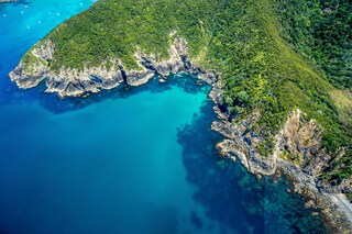
The Tasman Sea on the west and the Pacific Ocean on the east meet at thetop of North Island at Cape Reinga. No matter what route you take, you'll passfarms and forests, marvellous beaches, and great open spaces. The East Coast,up to the Bay of Islands, is Northland's most densely populated, often withrefugees from bigger cities—looking for a more relaxed life—clustered aroundbreathtaking beaches. The first decision on the drive north comes at the footof the Brynderwyn Hills. Turning left will take you up the West Coast throughareas once covered with forests and now used for either agricultural orhorticulture. Driving over "the Brynderwyns," as they are known,takes you to Whangarei, the only city in Northland. If you're in the mood for adiversion, you can slip to the beautiful coastline and take in Waipu Cove, anarea settled by Scots, and Laings Beach, where million-dollar homes sit next tosmall Kiwi beach houses.An hour's drive farther north is the Bay of Islands, known all over theworld for its beauty. There you will find lush forests, splendid beaches, andshimmering harbors. The Treaty of Waitangi was signed here in 1840 betweenMāoriand the British Crown, establishing the basis for the modern New Zealandstate. Every year on February 6, the extremely beautiful Waitangi Treaty Ground(the name means weeping waters) is the sight of a celebration of the treaty andprotests by Māori unhappy with it. Continuing north on the East Coast, theagricultural backbone of the region is even more evident and a series ofwinding loop roads off the main highway will take you to beaches that are bothbeautiful and isolated where you can swim, dive, picnic, or just laze. .The West Coast is even less populated, and the coastline is rugged andwindswept. In the Waipoua Forest, you will find some of New Zealand's oldestand largest kauri trees; the winding road will also take you past mangroveswamps. Crowning the region is the spiritually significant Cape Reinga, theheadland at the top of the vast stretch of 90 Mile Beach, where it's believedMāori souls depart after death. Today Māori make up roughly a quarter of thearea's population (compared with the national average of about 15%). The legendaryMāori navigator Kupe was said to have landed on the shores of Hokianga Harbour,where the first arrivals made their home. Many different wi (tribes) livedthroughout Northland, including Ngapuhi (the largest), Te Roroa, Ngati Wai,Ngati Kuri, Te Aupouri, Ngaitakoto, Ngati Kahu, and Te Rarawa. Many Māoriherecan trace their ancestry to the earliest inhabitants
Lautoka, Fiji
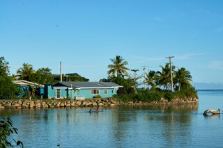
North of Nadi through sugarcane plantations and past the Sabeto Mountains is Lautoka, nicknamed the Sugar City for the local agriculture and its big processing mill. With a population of around 50,000, it's the only city besides Suva and, like the capital, has a pleasant waterfront. It's the sailing point for Blue Lagoon and Beachcomber Cruises but is otherwise unremarkable for tourists, itself having few hotels and fewer good restaurants. Locals recommend the city as a less-expensive place to shop for clothing, but note that it can take as long as 45 minutes to drive here. Legend has it that Lautoka acquired its name when two chiefs engaged in combat and one hit the other with a spear. He proclaimed "lau toka" (spear hit) and thus the future town was named.
Date & price
Select guest
Flights included
Departs
Sun 28 Jan 2029
from £13,440 pp
Enquire now Call 020 7590 0610Per person, based on two sharing, flights included. Updated daily and confirmed when you book. Flights from UK airports only.