
Summary
Explore the breathtaking landscapes and vibrant culture of the Caribbean Sea. On the Panamanian and Colombian coastlines, lush mangroves and lively towns recount the colonial past of the region, featuring Congo ceremonies and sleepy ruins. Off the coast, the turquoise sea wraps itself around stunning archipelagos, such as the San Blas Islands, home to the Kuna community, or the Grenadines, like a confetti of islets bound together by the most beautiful coral reef in the West Indies. In these crystal-clear waters, the underwater life is mesmerising, as are the panoramas provided by the Pitons of Saint Lucia and the gentle Creole way of life pervading Les Saintes.
Itinerary & Map
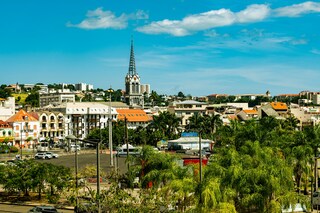
The largest of the Windward Islands, Martinique is 4,261 mi (6,817 km) from Paris, but its spirit and language are decidedly French, with more than a soupçon of...
Full description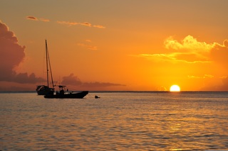
This small group of islands lies opposite the western part of Guadeloupe. They were discovered in November 1493 by Columbus, who named them Los Santos. French s...
Full description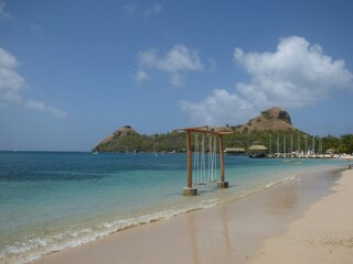
Pigeon Island is a 44-acre islet located in Gros Islet in the northern region of Saint Lucia. Once isolated from the country in the Caribbean Sea, the island wa...
Full description
Bequia is a Carib word meaning "island of the cloud." Hilly and green with several golden-sand beaches, Bequia is 9 miles (14½ km) south of St. Vincent's southw...
Full description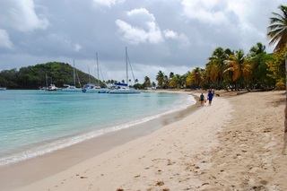
The small island of Mayreau, just one and 1/2 square miles in area (3.9 square kilometres) is the smallest inhabited island of The Grenadines, and is part of th...
Full description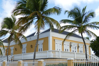
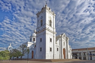

Cartagena's magnificent city walls and fortresses, now a UNESCO World Heritage Site, enclose a well-restored historic center (the Cuidad Amurallada, or walled c...
Full description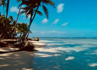
The San Blas archipelago is located off the Caribbean coast, east of Colon, and is made up of 365 islands that range in size from tiny ones with a few coconut p...
Full description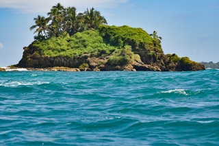
The provincial capital of Colón, beside the canal's Atlantic entrance, is named for the Spanish-language surname of Christopher Columbus, though the Americans c...
Full description
The largest of the Windward Islands, Martinique is 4,261 mi (6,817 km) from Paris, but its spirit and language are decidedly French, with more than a soupçon of...
Full description
This small group of islands lies opposite the western part of Guadeloupe. They were discovered in November 1493 by Columbus, who named them Los Santos. French s...
Full description
Pigeon Island is a 44-acre islet located in Gros Islet in the northern region of Saint Lucia. Once isolated from the country in the Caribbean Sea, the island wa...
Full description
Bequia is a Carib word meaning "island of the cloud." Hilly and green with several golden-sand beaches, Bequia is 9 miles (14½ km) south of St. Vincent's southw...
Full description
The small island of Mayreau, just one and 1/2 square miles in area (3.9 square kilometres) is the smallest inhabited island of The Grenadines, and is part of th...
Full description
Cartagena's magnificent city walls and fortresses, now a UNESCO World Heritage Site, enclose a well-restored historic center (the Cuidad Amurallada, or walled c...
Full description
The San Blas archipelago is located off the Caribbean coast, east of Colon, and is made up of 365 islands that range in size from tiny ones with a few coconut p...
Full description
The provincial capital of Colón, beside the canal's Atlantic entrance, is named for the Spanish-language surname of Christopher Columbus, though the Americans c...
Full descriptionFort-de-France
The largest of the Windward Islands, Martinique is 4,261 mi (6,817 km) from Paris, but its spirit and language are decidedly French, with more than a soupçon of West Indian spice. Tangible, edible evidence of the fact is the island's cuisine, a superb blend of French and creole. Martinique is lushly landscaped with tropical flowers. Trees bend under the weight of fruits such as mangoes, papayas, lemons, limes, and bright-red West Indian cherries. Acres of banana plantations, pineapple fields, and waving sugarcane stretch to the horizon. The towering mountains and verdant rain forest in the north lure hikers, while underwater sights and sunken treasures attract snorkelers and scuba divers. Martinique is also wonderful if your idea of exercise is turning over every 10 minutes to get an even tan and your taste in adventure runs to duty-free shopping. A popular cruise-ship excursion goes to St-Pierre, which was buried by ash when Mont Pelée erupted in 1902.
Îles des Saintes
This small group of islands lies opposite the western part of Guadeloupe. They were discovered in November 1493 by Columbus, who named them Los Santos. French settlers established themselves in 1648 and changed the name to Iles des Saintes, commonly known as Les Saintes. Since then the islands have been closely connected with Guadeloupe. Until a recent influx of tourism, Les Saintes were among the Caribbean’s most unspoiled destinations. Only two of the eight islands are inhabited: Terre-de-Bas and Terre-de-Haut. The latter is known for its impressive Fort Napoleon built in the early 19th century to replace an earlier 17th-century fort. From its vantage point there are fine views of the many tiny islets scattered in the bay and across to Guadeloupe. Terre-de-Haut is the main island of Les Saintes, with steeply scarped hills, scenic valleys, hidden coves and beautiful beaches. Its main settlement consists of a charming village of red-roofed houses situated along a curving bay. A number of small boutiques and gift shops invite browsing. Quaint cafés and restaurants offer food and drink. To the east of the village lies Grande Anse, a fine sand beach. Most of the attractions on this small island can be seen on foot. With just a few vehicles on the island, there are no organized tours possible. Time ashore here is at your leisure.
Pigeon Island and Sailing along the Pitons
Port Elizabeth, Bequia
Bequia is a Carib word meaning "island of the cloud." Hilly and green with several golden-sand beaches, Bequia is 9 miles (14½ km) south of St. Vincent's southwestern shore; with a population of 5,000, it's the largest of the Grenadines. Although boatbuilding, whaling, and fishing have been the predominant industries here for generations, sailing has now become almost synonymous with Bequia. Admiralty Bay is a favored anchorage for both privately owned and chartered yachts. Lodgings range from comfortable resorts and villas to cozy West Indian—style inns. Bequia's airport and the frequent ferry service from St. Vincent make this a favorite destination for day-trippers, as well. The ferry docks in Port Elizabeth, a tiny town with waterfront bars, restaurants, and shops where you can buy handmade souvenirs—including the exquisitely detailed model sailboats that are a famous Bequia export. The Easter Regatta is held during the four-day Easter weekend, when revelers gather to watch boat races and celebrate the island's seafaring traditions with food, music, dancing, and competitive games.To see the views, villages, beaches, and boatbuilding sites around Bequia, hire a taxi at the jetty in Port Elizabeth. Several usually line up under the almond trees to meet each ferry from St. Vincent.
Mayreau Island
The small island of Mayreau, just one and 1/2 square miles in area (3.9 square kilometres) is the smallest inhabited island of The Grenadines, and is part of the independent state of St.Vincent in the eastern Caribbean Sea. Two of the best known islands in The Grenadines are Mustique and Bequia, the second largest island in this group. The Grenadine Islands are strung out in a gentle sweep between St.Vincent and Grenada. Most visitors to Mayreau arrive from cruise ships, on the regular ferry, or by yacht. There are no proper roads on the island, only a few vehicles, no airport and only a single unnamed village. Mayreau and the neighboring Tobago Cays are very popular for divers and snorkellers. Saline Bay, on the west coast of the island, has a wonderful broad beach and a few local vendors selling T-shirts and local craft. A climb up the road to the hilltop village on the island provides breathtaking views across Mayreau, Canouan, the Tobago Cays and Carriacou.
Cartagena
Cartagena's magnificent city walls and fortresses, now a UNESCO World Heritage Site, enclose a well-restored historic center (the Cuidad Amurallada, or walled city) with plazas, churches, museums, and shops that have made it a lively coastal vacation spot for South Americans and others. New hotels and restaurants make the walled city a desirable place to stay, and the formerly down-at-the-heels Getsemaní neighborhood attracts those seeking a bohemian buzz. The historic center is a small section of Cartagena; many hotels are in the Bocagrande district, an elongated peninsula where high-rise hotels overlook a long, gray-sand beach.When it was founded in 1533 by Spanish conquistador Pedro de Heredia, Cartagena was the only port on the South American mainland. Gold and silver looted from indigenous peoples passed through here en route to Spain and attracted pirates, including Sir Francis Drake, who in 1586 torched 200 buildings. Cartagena's walls protected the city's riches as well as the New World's most important African slave market.
San Blas Islands
The San Blas archipelago is located off the Caribbean coast, east of Colon, and is made up of 365 islands that range in size from tiny ones with a few coconut palms to islands on which hundreds of Kuna Indians live. Only about fifty are inhabited. The Kuna rule the San Blas Territory with internal autonomy, and have tightly preserved their language and cultural traditions over the centuries despite influences from European colonies. In addition to their own language, Spanish is widely spoken and many men work on the mainland, but live on the islands. Women wear costumes with unique designs based on local themes, geometric patterns, and stylised fauna and flora. The island of El Porvenir is one of the main seats of government for the Kuna Indians. Many Kunas from the other islands came to settle on El Porvenir, bringing with them their traditional arts and crafts, including the famous molas. These intricately hand-sewn designs are made by the women of the tribes as part of their blouses and dresses. With the increased tourism, molas are now a favoured souvenir and craft item for visitors.
Colón
The provincial capital of Colón, beside the canal's Atlantic entrance, is named for the Spanish-language surname of Christopher Columbus, though the Americans called it Aspinwall in the 19th century.. The city was founded in 1850 by Americans working on the Panama railroad and named Aspinwall for one of the railway engineers. Following completion in 1855, Colon gained in importance, which was furthered by the plans for an isthmian canal. During the time of the French canal attempt, a fire in 1885 burned the city nearly to the ground and left thousands of people homeless. Colon was rebuilt in the architectural style then popular in France. Buildings from that era plus the ones constructed by Americans between 1904 and 1914 are still in use today, although the majority is on the verge of collapse. In addition to its importance as a port, Colon boasts the world’s second largest duty-free zone, known as Zona Libre, which is contained in a huge fortress like, walled-off area with giant international stores. However, most of the merchandise is sold in bulk to commercial businesses throughout the country.
Dates & prices
Select guest
Departs
Mon 26 Oct 2026
Le Bellot
from £6,340 pp
Enquire now Call 020 7590 0610Per person, based on two sharing, cruise only. Updated daily and confirmed when you book.