
Summary
Itinerary & Map
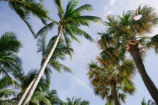
Like many southeast Florida neighbors, Fort Lauderdale has long been revitalizing. In a state where gaudy tourist zones often stand aloof from workaday downtown...
Full description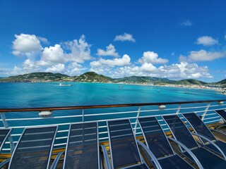
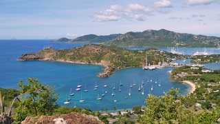
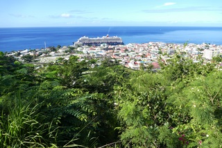
Although it's one of the smallest capitals in the Caribbean, Roseau has the highest concentration of inhabitants of any town in the eastern Caribbean. Caribbean...
Full description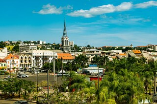
The largest of the Windward Islands, Martinique is 4,261 mi (6,817 km) from Paris, but its spirit and language are decidedly French, with more than a soupçon of...
Full description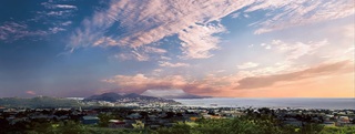
Mountainous St. Kitts, the first English settlement in the Leeward Islands, crams some stunning scenery into its 65 square miles (168 square km). Vast, brillian...
Full description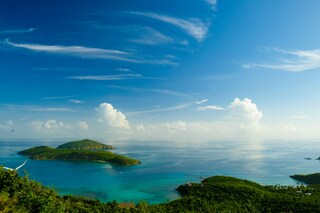
If you fly to the 32-square-mile (83-square-km) island of St. Thomas, you land at its western end; if you arrive by cruise ship, you come into one of the world'...
Full description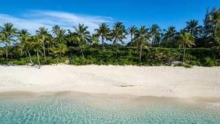
The Half Moon Caye is a natural monument situated at the southeast corner of Lighthouse Reef Atoll. The crescent-shaped caye is a protected marine reserve that...
Full description
Like many southeast Florida neighbors, Fort Lauderdale has long been revitalizing. In a state where gaudy tourist zones often stand aloof from workaday downtown...
Full description
Like many southeast Florida neighbors, Fort Lauderdale has long been revitalizing. In a state where gaudy tourist zones often stand aloof from workaday downtown...
Full description
Although it's one of the smallest capitals in the Caribbean, Roseau has the highest concentration of inhabitants of any town in the eastern Caribbean. Caribbean...
Full description
The largest of the Windward Islands, Martinique is 4,261 mi (6,817 km) from Paris, but its spirit and language are decidedly French, with more than a soupçon of...
Full description
Mountainous St. Kitts, the first English settlement in the Leeward Islands, crams some stunning scenery into its 65 square miles (168 square km). Vast, brillian...
Full description
If you fly to the 32-square-mile (83-square-km) island of St. Thomas, you land at its western end; if you arrive by cruise ship, you come into one of the world'...
Full description
The Half Moon Caye is a natural monument situated at the southeast corner of Lighthouse Reef Atoll. The crescent-shaped caye is a protected marine reserve that...
Full description
Like many southeast Florida neighbors, Fort Lauderdale has long been revitalizing. In a state where gaudy tourist zones often stand aloof from workaday downtown...
Full descriptionFort Lauderdale, Florida
Like many southeast Florida neighbors, Fort Lauderdale has long been revitalizing. In a state where gaudy tourist zones often stand aloof from workaday downtowns, Fort Lauderdale exhibits consistency at both ends of the 2-mile Las Olas corridor. The sparkling look results from upgrades both downtown and on the beachfront. Matching the downtown's innovative arts district, cafés, and boutiques is an equally inventive beach area, with hotels, cafés, and shops facing an undeveloped shoreline, and new resort-style hotels replacing faded icons of yesteryear. Despite wariness of pretentious overdevelopment, city leaders have allowed a striking number of glittering high-rises. Nostalgic locals and frequent visitors fret over the diminishing vision of sailboats bobbing in waters near downtown; however, Fort Lauderdale remains the yachting capital of the world, and the water toys don’t seem to be going anywhere.
Roseau
Although it's one of the smallest capitals in the Caribbean, Roseau has the highest concentration of inhabitants of any town in the eastern Caribbean. Caribbean vernacular architecture and a bustling marketplace transport visitors back in time. Although you can walk the entire town in about an hour, you'll get a much better feel for the place on a leisurely stroll. For some years now, the Society for Historical Architectural Preservation and Enhancement (SHAPE) has organized programs and projects to preserve the city's architectural heritage. Several interesting buildings have already been restored. Lilac House, on Kennedy Avenue, has three types of gingerbread fretwork, latticed verandah railings, and heavy hurricane shutters. The J.W. Edwards Building, at the corner of Old and King George V sreets, has a stone base and a wooden second-floor gallery. The Old Market Plaza is the center of Roseau's historic district, which was laid out by the French on a radial plan rather than a grid, so streets such as Hanover, King George V, and Old radiate from this area. South of the marketplace is the Fort Young Hotel, built as a British fort in the 18th century; the nearby statehouse, public library, and Anglican cathedral are also worth a visit. New developments at the bay front on Dame M.E. Charles Boulevard have brightened up the waterfront.
Fort-de-France
The largest of the Windward Islands, Martinique is 4,261 mi (6,817 km) from Paris, but its spirit and language are decidedly French, with more than a soupçon of West Indian spice. Tangible, edible evidence of the fact is the island's cuisine, a superb blend of French and creole. Martinique is lushly landscaped with tropical flowers. Trees bend under the weight of fruits such as mangoes, papayas, lemons, limes, and bright-red West Indian cherries. Acres of banana plantations, pineapple fields, and waving sugarcane stretch to the horizon. The towering mountains and verdant rain forest in the north lure hikers, while underwater sights and sunken treasures attract snorkelers and scuba divers. Martinique is also wonderful if your idea of exercise is turning over every 10 minutes to get an even tan and your taste in adventure runs to duty-free shopping. A popular cruise-ship excursion goes to St-Pierre, which was buried by ash when Mont Pelée erupted in 1902.
Basseterre, Saint Kitts
Mountainous St. Kitts, the first English settlement in the Leeward Islands, crams some stunning scenery into its 65 square miles (168 square km). Vast, brilliant green fields of sugarcane (the former cash crop, now slowly being replanted) run to the shore. The fertile, lush island has some fascinating natural and historical attractions: a rain forest replete with waterfalls, thick vines, and secret trails; a central mountain range dominated by the 3,792-foot Mt. Liamuiga, whose crater has long been dormant; and Brimstone Hill, known in the 18th century as the Gibraltar of the West Indies. St. Kitts and Nevis, along with Anguilla, achieved self-government as an associated state of Great Britain in 1967. In 1983 St. Kitts and Nevis became an independent nation. English with a strong West Indian lilt is spoken here. People are friendly but shy; always ask before you take photographs. Also, be sure to wear wraps or shorts over beach attire when you're in public places.
Saint Thomas
If you fly to the 32-square-mile (83-square-km) island of St. Thomas, you land at its western end; if you arrive by cruise ship, you come into one of the world's most beautiful harbors. Either way, one of your first sights is the town of Charlotte Amalie. From the harbor you see an idyllic-looking village that spreads into the lower hills. If you were expecting a quiet hamlet with its inhabitants hanging out under palm trees, you've missed that era by about 300 years. Although other islands in the USVI developed plantation economies, St. Thomas cultivated its harbor, and it became a thriving seaport soon after it was settled by the Danish in the 1600s. The success of the naturally perfect harbor was enhanced by the fact that the Danes—who ruled St. Thomas with only a couple of short interruptions from 1666 to 1917—avoided involvement in some 100 years' worth of European wars. Denmark was the only European country with colonies in the Caribbean to stay neutral during the War of the Spanish Succession in the early 1700s. Thus, products of the Dutch, English, and French islands—sugar, cotton, and indigo—were traded through Charlotte Amalie, along with the regular shipments of slaves. When the Spanish wars ended, trade fell off, but by the end of the 1700s Europe was at war again, Denmark again remained neutral, and St. Thomas continued to prosper. Even into the 1800s, while the economies of St. Croix and St. John foundered with the market for sugarcane, St. Thomas's economy remained vigorous. This prosperity led to the development of shipyards, a well-organized banking system, and a large merchant class. In 1845 Charlotte Amalie had 101 large importing houses owned by the English, French, Germans, Haitians, Spaniards, Americans, Sephardim, and Danes. Charlotte Amalie is still one of the world's most active cruise-ship ports. On almost any day at least one and sometimes as many as eight cruise ships are tied to the docks or anchored outside the harbor. Gently rocking in the shadows of these giant floating hotels are just about every other kind of vessel imaginable: sleek sailing catamarans that will take you on a sunset cruise complete with rum punch and a Jimmy Buffett soundtrack, private megayachts for billionaires, and barnacle-bottom sloops—with laundry draped over the lifelines—that are home to world-cruising gypsies. Huge container ships pull up in Sub Base, west of the harbor, bringing in everything from breakfast cereals to tires. Anchored right along the waterfront are down-island barges that ply the waters between the Greater Antilles and the Leeward Islands, transporting goods such as refrigerators, VCRs, and disposable diapers. The waterfront road through Charlotte Amalie was once part of the harbor. Before it was filled in to build the highway, the beach came right up to the back door of the warehouses that now line the thoroughfare. Two hundred years ago those warehouses were filled with indigo, tobacco, and cotton. Today the stone buildings house silk, crystal, and diamonds. Exotic fragrances are still traded, but by island beauty queens in air-conditioned perfume palaces instead of through open market stalls. The pirates of old used St. Thomas as a base from which to raid merchant ships of every nation, though they were particularly fond of the gold- and silver-laden treasure ships heading to Spain. Pirates are still around, but today's versions use St. Thomas as a drop-off for their contraband: illegal immigrants and drugs. To explore outside Charlotte Amalie, rent a car or hire a taxi. Your rental car should come with a good map; if not, pick up the pocket-size "St. Thomas–St. John Road Map" at a tourist information center. Roads are marked with route numbers, but they're confusing and seem to switch numbers suddenly. Roads are also identified by signs bearing the St. Thomas–St. John Hotel and Tourism Association's mascot, Tommy the Starfish. More than 100 of these color-coded signs line the island's main routes. Orange signs trace the route from the airport to Red Hook, green signs identify the road from town to Magens Bay, Tommy's face on a yellow background points from Mafolie to Crown Bay through the north side, red signs lead from Smith Bay to Four Corners via Skyline Drive, and blue signs mark the route from the cruise-ship dock at Havensight to Red Hook. These color-coded routes are not marked on most visitor maps, however. Allow yourself a day to explore, especially if you want to stop to take pictures or to enjoy a light bite or refreshing swim. Most gas stations are on the island's more populated eastern end, so fill up before heading to the north side. And remember to drive on the left!
Half Moon Cay
The Half Moon Caye is a natural monument situated at the southeast corner of Lighthouse Reef Atoll. The crescent-shaped caye is a protected marine reserve that was established as a World Heritage Site in 1996. The pristine caye has breath-taking walk-in snorkelling from the beach, idyllic sandy beaches and magnificent wildlife both in the sea and within the littoral forest.
Dates & prices
Departs
Sat 12 Feb 2028
Eurodam
from £2,299 pp
Enquire now Call 020 7590 0610Per person, based on two sharing, cruise only. Updated daily and confirmed when you book.