
Summary
Itinerary & Map
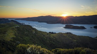
Your initial impression of Christchurch will likely be one of a genteel, green city. Joggers loop through shady Hagley Park, and punters ply the narrow Avon Riv...
Full description
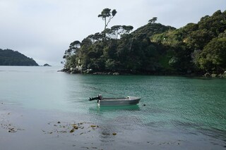
Stewart Island is home to New Zealand's newest national park, Rakiura National Park. The third and most southerly of New Zealand's main islands, Stewart Island...
Full description
Clinging to the walls of the natural amphitheater at the west end of Otago Harbour, the South Island's second-largest city is enriched with inspiring nearby sea...
Full description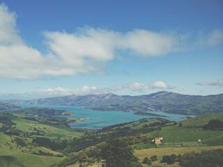
New Zealand's capital is, arguably, the country's most cosmopolitan metropolis. It's world-class Te Papa Tongarewa-Museum of New Zealand is a don't-miss attract...
Full description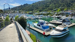
The maritime township of Picton (population 4,000) lies at the head of Queen Charlotte Sound and is the arrival point for ferries from the North Island, as well...
Full description
The Tasman Sea on the west and the Pacific Ocean on the east meet at thetop of North Island at Cape Reinga. No matter what route you take, you'll passfarms and...
Full description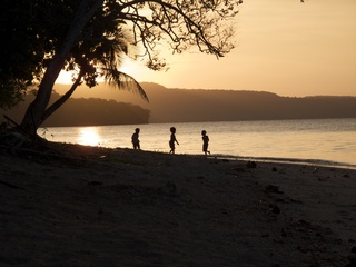
Lifou is a commune of France in the Loyalty Islands of New Caledonia. Lifou is made up of two main islands - Lifou Island and Tiga Island- in additional to a nu...
Full description
With its elegant urban infrastructure in a stunning natural setting, Noumea is a truly unique island and part of the New Caledonia archipelago. Noumea started a...
Full description
Your initial impression of Christchurch will likely be one of a genteel, green city. Joggers loop through shady Hagley Park, and punters ply the narrow Avon Riv...
Full description
Stewart Island is home to New Zealand's newest national park, Rakiura National Park. The third and most southerly of New Zealand's main islands, Stewart Island...
Full description
Clinging to the walls of the natural amphitheater at the west end of Otago Harbour, the South Island's second-largest city is enriched with inspiring nearby sea...
Full description
New Zealand's capital is, arguably, the country's most cosmopolitan metropolis. It's world-class Te Papa Tongarewa-Museum of New Zealand is a don't-miss attract...
Full description
The maritime township of Picton (population 4,000) lies at the head of Queen Charlotte Sound and is the arrival point for ferries from the North Island, as well...
Full description
The Tasman Sea on the west and the Pacific Ocean on the east meet at thetop of North Island at Cape Reinga. No matter what route you take, you'll passfarms and...
Full description
Lifou is a commune of France in the Loyalty Islands of New Caledonia. Lifou is made up of two main islands - Lifou Island and Tiga Island- in additional to a nu...
Full description
With its elegant urban infrastructure in a stunning natural setting, Noumea is a truly unique island and part of the New Caledonia archipelago. Noumea started a...
Full descriptionLyttelton
Your initial impression of Christchurch will likely be one of a genteel, green city. Joggers loop through shady Hagley Park, and punters ply the narrow Avon River, which bubbles between banks lined with willows and oaks. With a population approaching 350,000, Christchurch is the largest South Island city, and the second-largest in the country. It is also the forward supply depot for the main U.S. Antarctic base at McMurdo Sound. The face of Christchurch is changing rapidly, fueled by both internal and international immigration. The Māori community, although still below the national average in size, is growing. Ngai Tahu, the main South Island Māori tribe, settled Treaty of Waitangi claims in 1997 and have been investing in tourism ventures. Old wooden bungalows are making way for town houses, the arts scene is flourishing, and the city's university attracts cutting-edge technology companies. In short, there's plenty of fresh energy percolating underneath the English veneer.
Oban, Stewart Island
Stewart Island is home to New Zealand's newest national park, Rakiura National Park. The third and most southerly of New Zealand's main islands, Stewart Island is separated from the South Island by the 24-km (15-miles) Foveaux Strait. Its original Māori name, Te Punga O Te Waka a Maui, means "the anchor stone of Maui's canoe." Māori mythology says the island's landmass held the god Maui's canoe secure while he and his crew raised the great fish—the North Island. Today the island is more commonly referred to by its other Māori name, Rakiura, which means "the land of the glowing skies." This refers to the spectacular sunrises and sunsets and to the southern lights, or aurora australis. The European name of Stewart Island dates back to 1809. It memorializes an officer William W. Stewart on an early sealing vessel, the Pegasus, who was the first to chart the island. The island covers some 1,700 square km (650 square miles). It measures about 75 km (46 miles) from north to south and about the same distance across at its widest point. On the coastline, sharp cliffs rise from a succession of sheltered bays and beaches. In the interior, forested hills rise gradually toward the west side of the island. Seals and penguins frequent the coast, and the island's prolific birdlife includes a number of species rarely seen in any other part of the country. In fact, this is the surest place to see a kiwi. The Stewart Island brown kiwi, or tokoeka, is the largest species of this kind of bird. Unlike their mainland cousins, these kiwis can be seen during the day as well as at night. It's a rare and amusing experience to watch these pear-shape birds scampering on a remote beach as they feed on sand hoppers and grubs. Māori have visited Stewart Island for centuries. Archaeologists' studies of 13th-century Māori middens (refuse heaps) indicate that the island was once a rich, seasonal resource for hunting, fishing, and gathering seafood. A commonly eaten delicacy at that time, the titi, also known as the muttonbird, still occasionally appears on menus. In the early 19th century, explorers, sealers, missionaries, and miners settled the island. They were followed by fishermen and sawmillers who established settlements around the edges of Paterson Inlet and Halfmoon and Horseshoe bays. In the 1920s Norwegians set up a whaling enterprise, and many descendants of these seafaring people remain. Fishing, aquaculture, and tourism are now the mainstays of the island's economy. Even by New Zealand standards, Stewart Island is remote, raw, and untouched. The appeal is its seclusion, its relaxed way of life, and its untouched quality. Stewart Island is not for everyone: if you must have shopping malls, casinos, or umbrella drinks on the beach, don't come here. Visitors should be prepared for the fact that Stewart Island can be chilly, windy, and rainy, even in the middle of summer.
Dunedin
Clinging to the walls of the natural amphitheater at the west end of Otago Harbour, the South Island's second-largest city is enriched with inspiring nearby seascapes and wildlife. Because Dunedin is a university town, floods of students give the city a vitality far greater than its population of 122,000 might suggest. Its manageable size makes it easy to explore on foot—with the possible exception of Baldwin Street, the world's steepest residential street and home to the annual "gutbuster" race, in which people run up it, and the "Jaffa" race, in which people roll the namesake spherical chocolate candy down it.Dunedin, the Gaelic name for Edinburgh, was founded in 1848 by settlers of the Free Church of Scotland, a breakaway group from the Presbyterian Church. The city's Scottish roots are still visible; you'll find New Zealand's first and only (legal) whisky distillery, a statue of Scottish poet Robert Burns, and more kilts, sporrans, and gillies than you can shake a stick at! The Scottish settlers and local Māori came together in relative peace, but this wasn't true of the European whalers who were here three decades before, as places with names such as Murdering Beach illustrate.Dunedin has always had a reputation for the eccentric. Wearing no shoes and a big beard here marks a man as bohemian rather than destitute, and the residents wouldn't have it any other way. The University of Otago was the country's first university and has been drawing writers ever since its founding in 1871, most notably Janet Frame and the poet James K. Baxter. Dunedin also has a musical heritage, which blossomed into the "Dunedin Sound" of the 1970s and '80s.
Wellington
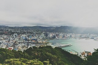
New Zealand's capital is, arguably, the country's most cosmopolitan metropolis. It's world-class Te Papa Tongarewa-Museum of New Zealand is a don't-miss attraction, and the burgeoning film industry led, of course, by the Lord of the Rings extravaganzas has injected new life into the local arts scene. Attractive and compact enough to be explored easily on foot, Wellington is a booming destination. Modern high-rise buildings gaze over Port Nicholson, surely one of the finest natural anchorages in the world. Known to local Māori as The Great Harbor of Tara, its two massive arms form the jaws of the fish of Maui from Māori legend. Sometimes referred to as the windy city, Wellington has been the seat of New Zealand's government since 1865.
Picton
The maritime township of Picton (population 4,000) lies at the head of Queen Charlotte Sound and is the arrival point for ferries from the North Island, as well as a growing number of international cruise ships. It plays a major role in providing services and transport by water taxi to a multitude of remote communities in the vast area of islands, peninsulas, and waterways that make up the Marlborough Sounds Maritime Park. There's plenty to do in town, with crafts markets in summer, historical sights to see, and walking tracks to scenic lookouts over the sounds. The main foreshore is lined by London Quay, which looks up Queen Charlotte Sound to the bays beyond. High Street runs down to London Quay from the hills, and between them these two streets make up the center of town.
Auckland
Bay of Islands
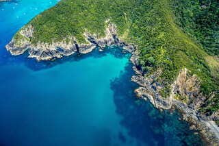
The Tasman Sea on the west and the Pacific Ocean on the east meet at thetop of North Island at Cape Reinga. No matter what route you take, you'll passfarms and forests, marvellous beaches, and great open spaces. The East Coast,up to the Bay of Islands, is Northland's most densely populated, often withrefugees from bigger cities—looking for a more relaxed life—clustered aroundbreathtaking beaches. The first decision on the drive north comes at the footof the Brynderwyn Hills. Turning left will take you up the West Coast throughareas once covered with forests and now used for either agricultural orhorticulture. Driving over "the Brynderwyns," as they are known,takes you to Whangarei, the only city in Northland. If you're in the mood for adiversion, you can slip to the beautiful coastline and take in Waipu Cove, anarea settled by Scots, and Laings Beach, where million-dollar homes sit next tosmall Kiwi beach houses.An hour's drive farther north is the Bay of Islands, known all over theworld for its beauty. There you will find lush forests, splendid beaches, andshimmering harbors. The Treaty of Waitangi was signed here in 1840 betweenMāoriand the British Crown, establishing the basis for the modern New Zealandstate. Every year on February 6, the extremely beautiful Waitangi Treaty Ground(the name means weeping waters) is the sight of a celebration of the treaty andprotests by Māori unhappy with it. Continuing north on the East Coast, theagricultural backbone of the region is even more evident and a series ofwinding loop roads off the main highway will take you to beaches that are bothbeautiful and isolated where you can swim, dive, picnic, or just laze. .The West Coast is even less populated, and the coastline is rugged andwindswept. In the Waipoua Forest, you will find some of New Zealand's oldestand largest kauri trees; the winding road will also take you past mangroveswamps. Crowning the region is the spiritually significant Cape Reinga, theheadland at the top of the vast stretch of 90 Mile Beach, where it's believedMāori souls depart after death. Today Māori make up roughly a quarter of thearea's population (compared with the national average of about 15%). The legendaryMāori navigator Kupe was said to have landed on the shores of Hokianga Harbour,where the first arrivals made their home. Many different wi (tribes) livedthroughout Northland, including Ngapuhi (the largest), Te Roroa, Ngati Wai,Ngati Kuri, Te Aupouri, Ngaitakoto, Ngati Kahu, and Te Rarawa. Many Māoriherecan trace their ancestry to the earliest inhabitants
Lifou Island
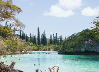
Lifou is a commune of France in the Loyalty Islands of New Caledonia. Lifou is made up of two main islands - Lifou Island and Tiga Island- in additional to a number of uninhabited islets. Lifou Isand is the largest atoll in the world. The island is actually made of fossilized coral - known as a makatea. Lifou island does not have any surface water and it relies on a freshwater reservoir accessed by caves. Lifou Island is best known for its vast atoll (the largest in the world). This ring-shaped coral reef affords some of the best snorkelling in the world. Popular activities on this island include scenic walks, relaxing days on the beach, swimming and snorkelling. There are no organized tours being offered during this call to Lifou Island, guests may explore on their own.
Nouméa
With its elegant urban infrastructure in a stunning natural setting, Noumea is a truly unique island and part of the New Caledonia archipelago. Noumea started as a penal colony, but has since evolved to a lovely metropolis and today has almost two thirds of New Caledonia’s population. While much of the archipelago of New Caledonia has a large percentage of Kanak people – the indigenous inhabitants who live in tribal areas across the country – Noumea is predominantly European with a strong French influence. The city’s center and Place de Cocotiers, the main park, are located close to the harbor and several churches date back to the late 19th century. Other attractions include a world-class aquarium at Anse Vata, several long beaches to the south, and a noteworthy collection of Kanak and South Pacific objects at the Museum of New Caledonia. The architectural gem of the city is the Tjibaou Cultural Center, the structure of which resembles sails, or the roofs of Kanak houses hidden behind mangroves.
Date & price
Departs
Fri 5 Mar 2027
from £9,451 pp
Enquire now Call 020 7590 0610Per person, based on two sharing, cruise only. Updated daily and confirmed when you book.