
Summary
Itinerary & Map

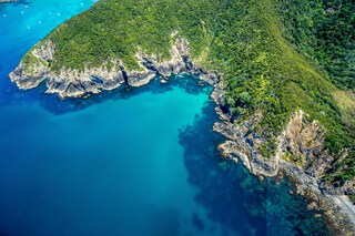
The Tasman Sea on the west and the Pacific Ocean on the east meet at thetop of North Island at Cape Reinga. No matter what route you take, you'll passfarms and...
Full descriptionNamed by Captain Cook in the 18th century for its prominent, spiny pine trees, Île des Pins is a vibrantly beautiful island located in the Pacific Ocean and par...
Full description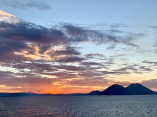
Rabaul, the former provincial capital, has quite a remarkable location. The town is inside the flooded caldera of a giant volcano and several sub-vents are stil...
Full description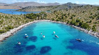
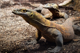
Pink Beach earned its name for the way the beach can appear to have a rosy hue in certain lights. The color comes from small flecks of red coral mixed in with t...
Full description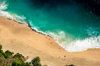
Bali really is as alluring as everyone says. This island, slightly bigger than Delaware, has it all: beaches, volcanoes, terraced rice fields, forests, renowned...
Full description
The Tasman Sea on the west and the Pacific Ocean on the east meet at thetop of North Island at Cape Reinga. No matter what route you take, you'll passfarms and...
Full descriptionNamed by Captain Cook in the 18th century for its prominent, spiny pine trees, Île des Pins is a vibrantly beautiful island located in the Pacific Ocean and par...
Full description
Rabaul, the former provincial capital, has quite a remarkable location. The town is inside the flooded caldera of a giant volcano and several sub-vents are stil...
Full description
Pink Beach earned its name for the way the beach can appear to have a rosy hue in certain lights. The color comes from small flecks of red coral mixed in with t...
Full description
Bali really is as alluring as everyone says. This island, slightly bigger than Delaware, has it all: beaches, volcanoes, terraced rice fields, forests, renowned...
Full descriptionAuckland
Bay of Islands
The Tasman Sea on the west and the Pacific Ocean on the east meet at thetop of North Island at Cape Reinga. No matter what route you take, you'll passfarms and forests, marvellous beaches, and great open spaces. The East Coast,up to the Bay of Islands, is Northland's most densely populated, often withrefugees from bigger cities—looking for a more relaxed life—clustered aroundbreathtaking beaches. The first decision on the drive north comes at the footof the Brynderwyn Hills. Turning left will take you up the West Coast throughareas once covered with forests and now used for either agricultural orhorticulture. Driving over "the Brynderwyns," as they are known,takes you to Whangarei, the only city in Northland. If you're in the mood for adiversion, you can slip to the beautiful coastline and take in Waipu Cove, anarea settled by Scots, and Laings Beach, where million-dollar homes sit next tosmall Kiwi beach houses.An hour's drive farther north is the Bay of Islands, known all over theworld for its beauty. There you will find lush forests, splendid beaches, andshimmering harbors. The Treaty of Waitangi was signed here in 1840 betweenMāoriand the British Crown, establishing the basis for the modern New Zealandstate. Every year on February 6, the extremely beautiful Waitangi Treaty Ground(the name means weeping waters) is the sight of a celebration of the treaty andprotests by Māori unhappy with it. Continuing north on the East Coast, theagricultural backbone of the region is even more evident and a series ofwinding loop roads off the main highway will take you to beaches that are bothbeautiful and isolated where you can swim, dive, picnic, or just laze. .The West Coast is even less populated, and the coastline is rugged andwindswept. In the Waipoua Forest, you will find some of New Zealand's oldestand largest kauri trees; the winding road will also take you past mangroveswamps. Crowning the region is the spiritually significant Cape Reinga, theheadland at the top of the vast stretch of 90 Mile Beach, where it's believedMāori souls depart after death. Today Māori make up roughly a quarter of thearea's population (compared with the national average of about 15%). The legendaryMāori navigator Kupe was said to have landed on the shores of Hokianga Harbour,where the first arrivals made their home. Many different wi (tribes) livedthroughout Northland, including Ngapuhi (the largest), Te Roroa, Ngati Wai,Ngati Kuri, Te Aupouri, Ngaitakoto, Ngati Kahu, and Te Rarawa. Many Māoriherecan trace their ancestry to the earliest inhabitants
Kuto Bay, Isle des Pins
Named by Captain Cook in the 18th century for its prominent, spiny pine trees, Île des Pins is a vibrantly beautiful island located in the Pacific Ocean and part of the New Caledonia archipelago. Surrounded by some of the world’s brightest aquamarine blue water, the island has also been nicknamed as “the closest island to paradise,” with tropical fish and coral that can be seen through the transparent waters of its lagoon. Île des Pins was used in the 19th century as a prison for political exiles from France and remains can still be seen at Kuto and in the village of Ouro. Today the island’s primary inhabitants of the island are the native Melanesian Kanaks, with 2,000 residents. One of the local sites to see on this island are the spear-shaped carvings surrounding a Catholic monument in the city of Kuto. The beaches in Kuto and close-by Kanumera are some of the finest beaches in the South Pacific and while Kuto is for swimming, Kanumera and the giant rock in its bay are for snorkelling.
Rabaul, Bismarck Archipelago
Rabaul, the former provincial capital, has quite a remarkable location. The town is inside the flooded caldera of a giant volcano and several sub-vents are still quite active today! The fumes of the volcano Tavurvur can be seen continually and the town suffered greatly during the last major eruption of 1994 when some 80% of the houses collapsed due to the ash raining down onto their roofs. Rabaul has a Volcano Observatory sitting atop the town’s center, monitoring the 14 active and 23 dormant volcanoes in Papua New Guinea. A small museum opposite the bunker used by Yamamoto during World War II shows exhibits relating to Rabaul’s local, German, Australian and Japanese past from the 19th century to Papua New Guinea’s independence in the 1970s.
Komodo Island
Pink Beach earned its name for the way the beach can appear to have a rosy hue in certain lights. The color comes from small flecks of red coral mixed in with the fine white reef sand. With a few trees along the beach for shade, this stretch of coast makes a fine place to relax or enjoy a snorkel or dive in the crystal clear waters. It is possible to spot a striped clown fish nestled among the protective tentacles of its sea anemone host, or to see a grouper lazily swimming by a flamboyant soft coral. The reef here is now protected by law and the maturing corals are a joy to behold.
Benoa, Bali
Bali really is as alluring as everyone says. This island, slightly bigger than Delaware, has it all: beaches, volcanoes, terraced rice fields, forests, renowned resorts, surfing, golf, and world-class dive sites. But what sets Bali apart from other nearby tropical destinations is Balinese tradition, and villagers dedicated to celebrating it. The hundreds of temples, dances, rituals, and crafts linked to their ancient Hindu faith aren't a show for tourists, but a living, breathing culture in which visitors are warmly received by the Balinese, who cherish their own identities.
Date & price
Departs
Tue 14 Mar 2028
from £14,670 pp
Enquire now Call 020 7590 0610Per person, based on two sharing, cruise only. Updated daily and confirmed when you book.