
Summary
Itinerary & Map
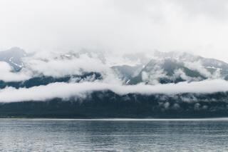
It is hard to believe that a place as beautiful as Seward exists. Surrounded on all sides by Kenai Fjords National Park, Chugach National Forest, and Resurrecti...
Full descriptionThe city of Saint Paul is located on a narrow peninsula on the southern tip of St. Paul Island, the largest of five islands in the Pribilofs. These islands are...
Full description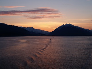
Nome is located on the edge of the Bering Sea, on the southwest side of the Seward Peninsula. Unlike other towns which are named for explorers, heroes or politi...
Full description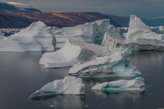
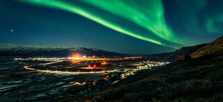
The name Kangerlussuaq means "Big Fjord" in the local Kalaallisut language. The settlement of about 500 people is located in western Greenland on flat land at t...
Full description
It is hard to believe that a place as beautiful as Seward exists. Surrounded on all sides by Kenai Fjords National Park, Chugach National Forest, and Resurrecti...
Full descriptionThe city of Saint Paul is located on a narrow peninsula on the southern tip of St. Paul Island, the largest of five islands in the Pribilofs. These islands are...
Full description
Nome is located on the edge of the Bering Sea, on the southwest side of the Seward Peninsula. Unlike other towns which are named for explorers, heroes or politi...
Full description
The name Kangerlussuaq means "Big Fjord" in the local Kalaallisut language. The settlement of about 500 people is located in western Greenland on flat land at t...
Full descriptionSeward, Alaska
It is hard to believe that a place as beautiful as Seward exists. Surrounded on all sides by Kenai Fjords National Park, Chugach National Forest, and Resurrection Bay, Seward offers all the quaint realities of a small railroad town with the bonus of jaw-dropping scenery. This little town of about 2,750 citizens was founded in 1903, when survey crews arrived at the ice-free port and began planning a railroad to the Interior. Since its inception, Seward has relied heavily on tourism and commercial fishing. It is also the launching point for excursions into Kenai Fjords National Park, where it is quite common to see marine life and calving glaciers.
Saint Paul Island, Alaska
The city of Saint Paul is located on a narrow peninsula on the southern tip of St. Paul Island, the largest of five islands in the Pribilofs. These islands are located in the middle of the Bering Sea between the United States and Russia. St Paul’s lies 240 miles north of the Aleutian Islands, 300 miles west of the Alaska mainland, and 750 air miles west of Anchorage. The city of St. Paul is the only residential area on the island. The first non-natives to ‘discover’ St. Paul were Russian fur-traders in the late 1780’s, led by the navigator, Gavriil Pribylov. Today, this small city has one school (K-12), one post office, one bar, one small general store, and one church, a Russian Orthodox Church that is registered National Historic building. In summer, this island is teaming with wildlife, including about 500,000 northern fur seals and millions of seabirds, including tufted puffins
Nome, Alaska
Nome is located on the edge of the Bering Sea, on the southwest side of the Seward Peninsula. Unlike other towns which are named for explorers, heroes or politicians, Nome was named as a result of a 50 year-old spelling error. In the 1850's an officer on a British ship off the coast of Alaska noted on a manuscript map that a nearby prominent point was not identified. He wrote "? Name" next to the point. When the map was recopied, another draftsman thought that the “?” was a C and that the “a” in "Name" was an o, and thus a map-maker in the British Admiralty christened "Cape Nome." The area has an amazing history dating back 10,000 years of Inupiaq Eskimo use for subsistence living. Modern history started in 1898 when "Three Lucky Swedes”, Jafet Lindberg, Erik Lindblom and John Brynteson, discovered gold in Anvil Creek…the rush was on! In 1899 the population of Nome swelled from a handful to 28,000. Today the population is just over 3,500. Much of Nome's gold rush architecture remains.
Kangerlussuaq Havn
The name Kangerlussuaq means "Big Fjord" in the local Kalaallisut language. The settlement of about 500 people is located in western Greenland on flat land at the head of a fjord with the same name. Kangerlussuaq is the site of Greenland's largest commercial airport and most of the economy here is dependent on the air transportation hub and tourism. The rugged lands around the settlement support terrestrial Arctic fauna including muskoxen, caribou, and Gyrfalcons.
Date & price
Departs
Sun 30 Jul 2028
from £24,675 pp
Enquire now Call 020 7590 0610Per person, based on two sharing, cruise only. Updated daily and confirmed when you book.