
Summary
Leaving Lautoka in our wake, we indulge in a lazy day at sea before arriving in Vanuatu on the powdery soft sands of Champagne Bay. Then it's on to the capital, Port Vila, where you can walk in the rainforest or buy handicrafts at the local market. The uninhabited Mystery Island follows, which is so small that you can stroll along its entire shoreline in as little as 40 minutes. Next is Lifou, the largest of the Loyalty Islands in the nation of New Caledonia, the very picture of a tropical paradise. Noumea, capital of this island chain, follows, adding French bistros and chic shopping in the mix with yet more gorgeous beaches. Watch the world go by as we spend two days at sea bound for the Bay of Islands, rich in nature, which marks our arrival in New Zealand. Finally we arrive in cosmopolitan Auckland, where there are natural and cultural treasures to discover.
Itinerary & Map
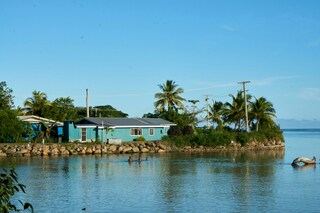
North of Nadi through sugarcane plantations and past the Sabeto Mountains is Lautoka, nicknamed the Sugar City for the local agriculture and its big processing...
Full descriptionChampagne Beach is found in Hog Harbor on Espiritu Santo Island in Vanuatu. The island got its European name in the early 17th century when Pedro de Quiroz beli...
Full description
Vanuatu is an island nation located in the southern Pacific Ocean. The archipelago, which is of volcanic origin, is approximately 1,090 miles (about 1,750 kilom...
Full description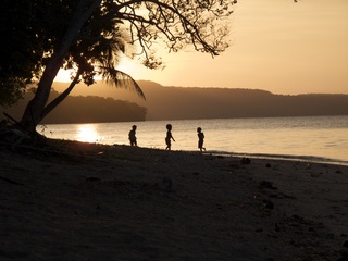
Lifou is a commune of France in the Loyalty Islands of New Caledonia. Lifou is made up of two main islands - Lifou Island and Tiga Island- in additional to a nu...
Full description
With its elegant urban infrastructure in a stunning natural setting, Noumea is a truly unique island and part of the New Caledonia archipelago. Noumea started a...
Full description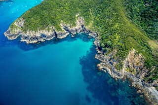
The Tasman Sea on the west and the Pacific Ocean on the east meet at thetop of North Island at Cape Reinga. No matter what route you take, you'll passfarms and...
Full description
North of Nadi through sugarcane plantations and past the Sabeto Mountains is Lautoka, nicknamed the Sugar City for the local agriculture and its big processing...
Full descriptionChampagne Beach is found in Hog Harbor on Espiritu Santo Island in Vanuatu. The island got its European name in the early 17th century when Pedro de Quiroz beli...
Full description
Vanuatu is an island nation located in the southern Pacific Ocean. The archipelago, which is of volcanic origin, is approximately 1,090 miles (about 1,750 kilom...
Full description
Lifou is a commune of France in the Loyalty Islands of New Caledonia. Lifou is made up of two main islands - Lifou Island and Tiga Island- in additional to a nu...
Full description
With its elegant urban infrastructure in a stunning natural setting, Noumea is a truly unique island and part of the New Caledonia archipelago. Noumea started a...
Full description
The Tasman Sea on the west and the Pacific Ocean on the east meet at thetop of North Island at Cape Reinga. No matter what route you take, you'll passfarms and...
Full description
Lautoka
North of Nadi through sugarcane plantations and past the Sabeto Mountains is Lautoka, nicknamed the Sugar City for the local agriculture and its big processing mill. With a population of around 50,000, it's the only city besides Suva and, like the capital, has a pleasant waterfront. It's the sailing point for Blue Lagoon and Beachcomber Cruises but is otherwise unremarkable for tourists, itself having few hotels and fewer good restaurants. Locals recommend the city as a less-expensive place to shop for clothing, but note that it can take as long as 45 minutes to drive here. Legend has it that Lautoka acquired its name when two chiefs engaged in combat and one hit the other with a spear. He proclaimed "lau toka" (spear hit) and thus the future town was named.
Champagne Beach, Espiritu Santo Island
Champagne Beach is found in Hog Harbor on Espiritu Santo Island in Vanuatu. The island got its European name in the early 17th century when Pedro de Quiroz believed he had reached the famous unknown southern land or the “Tierra Australis Incognita.” He called Vanuatu’s largest island, “La Austrialia del Espiritu Santo.” Huge fish poison trees and Alexandrian laurel give cooling shade to the picture-perfect beach and crystal-clear water. The name “Champagne Beach” comes from effervescent bubbles of volcanic origin that are occasionally found in the waters of this stunning spot.
Port Vila
Vanuatu is an island nation located in the southern Pacific Ocean. The archipelago, which is of volcanic origin, is approximately 1,090 miles (about 1,750 kilometres) east of northern Australia, approximately 310 miles (about 500 kilometres) northeast of New Caledonia, west of Fiji and southeast of the Solomon Islands, near New Guinea. Located on Mélé Bay along the southwest coast of Éfaté, Port Vila is the capital and largest city of Vanuatu, as well as its commercial and economic centre. Although Port Vila's British and French influences are apparent, its multinational population includes ni-Vanuatu, British, French, Chinese, and Vietnamese citizens. An active commercial port, the city is home to hospitals, hotels, casinos, markets and shopping districts, a sports stadium, cultural centre, teacher-training institution, campus of the University of the South Pacific, and several meat- and fish-processing plants. The municipality of Port Vila is divided into four wards, Malapoa-Tagabe, Anabrou-Melcofe-Tassiriki, Centre and South. The area occupied by Port Vila has been inhabited by Melanesian people for thousands of years. In 2004, an archaeological expedition unearthed a burial site with 25 tombs, skeletons and pieces of ceramic pottery dating from 1300 B.C. The Vanuatu Islands first had contact with Europeans in 1606 with the arrival of Portuguese explorer Pedro Fernandes de Queirós. Europeans did not return until 1768, when Louis Antoine de Bougainville rediscovered the islands. In 1774, Captain Cook called the islands the 'New Hebrides', a name that would last until their independence in 1980. In 1825, sandalwood was discovered on the island of Erromango, prompting a rush of immigrants that included Catholic and Protestant missionaries from European and North America, as well as settlers looking for land to farm cotton, coffee, cocoa, bananas, and coconuts. British subjects from Australia made up the majority of settlers, but the establishment of the Caledonian Company of the New Hebrides in 1882 attracted more French subjects. The land around Port Vila was converted into the municipality of Franceville in 1889. By the start of the 20th century, the French outnumbered the British, and the two nations agreed to govern the islands jointly by way of the British-French Condominium. During World War II, Port Vila was an American and Australian airbase. The New Hebrides National Party was established in the early-1970s. Renamed Vanua'aku Pati in 1974, the party pushed for independence. In 1980, amidst the brief Coconut War, the Republic of Vanuatu was created. The economies of Port Vila and Vanuatu are supported by the agriculture, offshore financial services and cattle industries. However, the abundant tropical beauty of Vanuatu has made Port Vila a popular tourist destination for outdoor and nature enthusiasts alike. Renowned for its tropical climate and exquisite, white-sand beaches and world-class fishing, the archipelago is a region of spectacular geographic diversity that includes spectacular volcanoes, mountains and valleys, along with idyllic jungles, rainforests, botanical gardens, mineral springs, and waterfalls. What's more, Port Vila offers easy access to exploring the city, Vanuatu and the offshore islands that comprise this wonderful South Pacific island chain. Port Vila consists of a diverse blend of Melanesian, Eastern and Western cultures that presents a unique opportunity to discover the people, traditions and history of Vanuatu. Cultural village tours are a fantastic way to meet the locals and experience indigenous lifestyles and customs through storytelling, music, dance, kava-tasting, and a traditional Melanesian feast. The evolution of Port Vila and Vanuatu can be explored during visits to the Vanuatu Cultural Centre and Museum features a collection of historical artefacts from the Vanuatu Island. Additional historic landmarks include Independence Park, the French and British residencies, Supreme Court, Georges Pompidou Building, World War I and II memorials, Tanna Coffee-Roasting Factory, and more. Vanuatu's verdant canyons, jungle-covered mountain peaks, volcanoes, waterfalls, botanical gardens, mineral springs, white-sand beaches, and rainforests invite a wide array of picturesque, memorable and exciting sightseeing venues for outdoor enthusiasts. Land-based excursions include bird-watching, bicycling and motor-biking, eco-tours, hiking through jungle and rainforest nature trails, horseback-riding at the nearby Sea Horse Ranch or Club Hippique Adventure Park, helicopter or seaplane flight-seeing, dune-bugging the beaches and jungles, 'zorbing' down the hillsides, abseiling down a cascading waterfall, volcano trekking and sandboarding, zip-lining through the jungle canopy, and golfing at the stunningly beautiful Port Vila Golf and Country Club, the only 18-hole championship course in Vanuatu and home to the PGA-sanctioned Vanuatu Open. Picturesque and fun-filled water-based excursions include swimming, boating and sailing along the exquisite coast of Port Vila and Vanuatu, deep-sea fishing for enormous dolphin, marlin, wahoo, dorado, tuna, swordfish, and sailfish, jet-skiing and high-speed jet-boating, stand-up paddle-boarding, surfing, kite-surfing, and parasailing. The archipelago also offers some of the world's finest snorkelling and diving at venues such as the Hideaway Islands Marine Reserves, JoJo Beach Club, Havannah Beach and Boat Club, and Iririki Island.Due to its compact size, Port Vila can be easily explored in just a single day.
Lifou Island
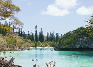
Lifou is a commune of France in the Loyalty Islands of New Caledonia. Lifou is made up of two main islands - Lifou Island and Tiga Island- in additional to a number of uninhabited islets. Lifou Isand is the largest atoll in the world. The island is actually made of fossilized coral - known as a makatea. Lifou island does not have any surface water and it relies on a freshwater reservoir accessed by caves. Lifou Island is best known for its vast atoll (the largest in the world). This ring-shaped coral reef affords some of the best snorkelling in the world. Popular activities on this island include scenic walks, relaxing days on the beach, swimming and snorkelling. There are no organized tours being offered during this call to Lifou Island, guests may explore on their own.
Nouméa
With its elegant urban infrastructure in a stunning natural setting, Noumea is a truly unique island and part of the New Caledonia archipelago. Noumea started as a penal colony, but has since evolved to a lovely metropolis and today has almost two thirds of New Caledonia’s population. While much of the archipelago of New Caledonia has a large percentage of Kanak people – the indigenous inhabitants who live in tribal areas across the country – Noumea is predominantly European with a strong French influence. The city’s center and Place de Cocotiers, the main park, are located close to the harbor and several churches date back to the late 19th century. Other attractions include a world-class aquarium at Anse Vata, several long beaches to the south, and a noteworthy collection of Kanak and South Pacific objects at the Museum of New Caledonia. The architectural gem of the city is the Tjibaou Cultural Center, the structure of which resembles sails, or the roofs of Kanak houses hidden behind mangroves.
Bay of Islands
The Tasman Sea on the west and the Pacific Ocean on the east meet at thetop of North Island at Cape Reinga. No matter what route you take, you'll passfarms and forests, marvellous beaches, and great open spaces. The East Coast,up to the Bay of Islands, is Northland's most densely populated, often withrefugees from bigger cities—looking for a more relaxed life—clustered aroundbreathtaking beaches. The first decision on the drive north comes at the footof the Brynderwyn Hills. Turning left will take you up the West Coast throughareas once covered with forests and now used for either agricultural orhorticulture. Driving over "the Brynderwyns," as they are known,takes you to Whangarei, the only city in Northland. If you're in the mood for adiversion, you can slip to the beautiful coastline and take in Waipu Cove, anarea settled by Scots, and Laings Beach, where million-dollar homes sit next tosmall Kiwi beach houses.An hour's drive farther north is the Bay of Islands, known all over theworld for its beauty. There you will find lush forests, splendid beaches, andshimmering harbors. The Treaty of Waitangi was signed here in 1840 betweenMāoriand the British Crown, establishing the basis for the modern New Zealandstate. Every year on February 6, the extremely beautiful Waitangi Treaty Ground(the name means weeping waters) is the sight of a celebration of the treaty andprotests by Māori unhappy with it. Continuing north on the East Coast, theagricultural backbone of the region is even more evident and a series ofwinding loop roads off the main highway will take you to beaches that are bothbeautiful and isolated where you can swim, dive, picnic, or just laze. .The West Coast is even less populated, and the coastline is rugged andwindswept. In the Waipoua Forest, you will find some of New Zealand's oldestand largest kauri trees; the winding road will also take you past mangroveswamps. Crowning the region is the spiritually significant Cape Reinga, theheadland at the top of the vast stretch of 90 Mile Beach, where it's believedMāori souls depart after death. Today Māori make up roughly a quarter of thearea's population (compared with the national average of about 15%). The legendaryMāori navigator Kupe was said to have landed on the shores of Hokianga Harbour,where the first arrivals made their home. Many different wi (tribes) livedthroughout Northland, including Ngapuhi (the largest), Te Roroa, Ngati Wai,Ngati Kuri, Te Aupouri, Ngaitakoto, Ngati Kahu, and Te Rarawa. Many Māoriherecan trace their ancestry to the earliest inhabitants
Auckland
Date & price
Select guest
Departs
Sat 20 Feb 2027
from £6,000 pp
Enquire now Call 020 7590 0610Per person, based on two sharing, cruise only. Updated daily and confirmed when you book.