
Summary
Welcome to Aurora Expeditions’ Northwest Passage expedition. Arctic from Greenland to the Canadian High Arctic on a journey shaped by ice, human ingenuity and centuries of polar ambition. Follow waterways long travelled by Inuit, whose knowledge of seasons, wildlife and sea ice made life—and later exploration—possible in this immense region. Along the way, encounter places associated with Franklin, Amundsen and the RCMP schooner St Roch, while archaeological sites reveal far older stories of Inuit adaptation and movement. Wildlife remains wonderfully unpredictable: watch for polar bears, walrus, musk oxen, seals, whales and Arctic birdlife as our route responds to weather and sea ice.
Itinerary & Map

Sprawling Reykjavík, the nation's nerve center and government seat, is home to half the island's population. On a bay overlooked by proud Mt. Esja (pronounced e...
Full description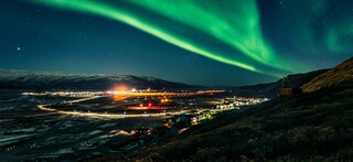
The name Kangerlussuaq means "Big Fjord" in the local Kalaallisut language. The settlement of about 500 people is located in western Greenland on flat land at t...
Full description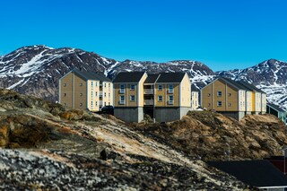
Located just north of the Arctic Circle, Sisimiut is the northernmost town in Greenland where the port remains free of ice in the winter. Yet it is also the sou...
Full description
Known as the birthplace of icebergs, the Ilulissat Icefjord produces nearly 20 million tons of ice each day. In fact, the word Ilulissat means “icebergs” in the...
Full descriptionAappilattoq is a small settlement near the western end of Prins Christian Sund in southwestern Greenland. In the local Greenlandic language the name means, "sea...
Full description
Located in northern Baffin Island, Pond Inlet is a small, predo¬minantly Inuit community, with a population of roughly 1,500 inhabitants. In 1818, the British e...
Full description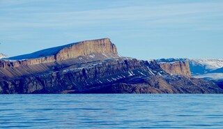
Dundas Harbour is located in the southeast of Devon Island, Canada’s 6th largest island. It is a forlorn but starkly beautiful spot. The island was first sighte...
Full description
Beechey Island is a small island off the southwest coast of Devon Island, separated by a narrow waterway called the Barrow Strait. Captain William Edward Parry...
Full description
Sprawling Reykjavík, the nation's nerve center and government seat, is home to half the island's population. On a bay overlooked by proud Mt. Esja (pronounced e...
Full description
The name Kangerlussuaq means "Big Fjord" in the local Kalaallisut language. The settlement of about 500 people is located in western Greenland on flat land at t...
Full description
Located just north of the Arctic Circle, Sisimiut is the northernmost town in Greenland where the port remains free of ice in the winter. Yet it is also the sou...
Full description
Known as the birthplace of icebergs, the Ilulissat Icefjord produces nearly 20 million tons of ice each day. In fact, the word Ilulissat means “icebergs” in the...
Full descriptionAappilattoq is a small settlement near the western end of Prins Christian Sund in southwestern Greenland. In the local Greenlandic language the name means, "sea...
Full description
Located in northern Baffin Island, Pond Inlet is a small, predo¬minantly Inuit community, with a population of roughly 1,500 inhabitants. In 1818, the British e...
Full description
Dundas Harbour is located in the southeast of Devon Island, Canada’s 6th largest island. It is a forlorn but starkly beautiful spot. The island was first sighte...
Full description
Beechey Island is a small island off the southwest coast of Devon Island, separated by a narrow waterway called the Barrow Strait. Captain William Edward Parry...
Full descriptionReykjavík
Sprawling Reykjavík, the nation's nerve center and government seat, is home to half the island's population. On a bay overlooked by proud Mt. Esja (pronounced eh-shyuh), with its ever-changing hues, Reykjavík presents a colorful sight, its concrete houses painted in light colors and topped by vibrant red, blue, and green roofs. In contrast to the almost treeless countryside, Reykjavík has many tall, native birches, rowans, and willows, as well as imported aspen, pines, and spruces.Reykjavík's name comes from the Icelandic words for smoke, reykur, and bay, vík. In AD 874, Norseman Ingólfur Arnarson saw Iceland rising out of the misty sea and came ashore at a bay eerily shrouded with plumes of steam from nearby hot springs. Today most of the houses in Reykjavík are heated by near-boiling water from the hot springs. Natural heating avoids air pollution; there's no smoke around. You may notice, however, that the hot water brings a slight sulfur smell to the bathroom.Prices are easily on a par with other major European cities. A practical option is to purchase a Reykjavík City Card at the Tourist Information Center or at the Reykjavík Youth Hostel. This card permits unlimited bus usage and admission to any of the city's seven pools, the Family Park and Zoo, and city museums. The cards are valid for one (ISK 3,300), two (ISK 4,400), or three days (ISK 4,900), and they pay for themselves after three or four uses a day. Even lacking the City Card, paying admission (ISK 500, or ISK 250 for seniors and people with disabilities) to one of the city art museums (Hafnarhús, Kjarvalsstaðir, or Ásmundarsafn) gets you free same-day admission to the other two.
Kangerlussuaq Havn
The name Kangerlussuaq means "Big Fjord" in the local Kalaallisut language. The settlement of about 500 people is located in western Greenland on flat land at the head of a fjord with the same name. Kangerlussuaq is the site of Greenland's largest commercial airport and most of the economy here is dependent on the air transportation hub and tourism. The rugged lands around the settlement support terrestrial Arctic fauna including muskoxen, caribou, and Gyrfalcons.
Sisimiut (Holsteinsborg)
Located just north of the Arctic Circle, Sisimiut is the northernmost town in Greenland where the port remains free of ice in the winter. Yet it is also the southernmost town where there is enough snow and ice to drive a dogsled in winter and spring. In Sisimiut, travelling by sled has been the primary means of winter transportation for centuries. In fact, the area has been inhabited for approximately 4,500 years. Modern Sisimiut is the largest business center in the north of Greenland, and is one of the fastest growing Greenlandic cities. Commercial fishing is the lead economy in the town‘s thriving industrial base.
Ilulissat (Jakobshavn)
Known as the birthplace of icebergs, the Ilulissat Icefjord produces nearly 20 million tons of ice each day. In fact, the word Ilulissat means “icebergs” in the Kalaallisut language. The town of Ilulissat is known for its long periods of calm and settled weather, but the climate tends to be cold due to its proximity to the fjord. Approximately 4,500 people live in Ilulissat, the third-largest town in Greenland after Nuuk and Sisimiut. Some people here estimate that there are nearly as many sled dogs as human beings living in the town that also boasts a local history museum located in the former home of Greenlandic folk hero and famed polar explorer Knud Rasmussen.
Aappilattoq
Aappilattoq is a small settlement near the western end of Prins Christian Sund in southwestern Greenland. In the local Greenlandic language the name means, "sea anemone". This small village of 130 inhabitants, hidden behind a prominent rock, offers a good insight into the life of Greenlandic Inuit. A stroll through the village will reveal a small school and a church, along with the likely possibility of seeing a polar bear skin drying in the wind behind a local dwelling. People have lived off the land in the area around Aappilattoq since the 19th century. The tradition continues today as most people here hunt and fish to make a living.
Pond Inlet, Nunavut
Located in northern Baffin Island, Pond Inlet is a small, predo¬minantly Inuit community, with a population of roughly 1,500 inhabitants. In 1818, the British explorer John Ross named a bay in the vicinity after the English astronomer John Pond. Today Pond Inlet is considered one of Canada's "jewels of the North" thanks to several picturesque glaciers and mountain ranges nearby. Many archaeological sites of ancient Dorset and Thule peoples can be found near Pond Inlet. The Inuit hunted caribou, ringed and harp seals, fish, polar bears, walrus, narwhals, geese, ptarmigans and Arctic hares, long before European and American whalers came here to harvest bowhead whales. Pond Inlet is also known as a major center of Inuit art, especially the printmaking and stone carving that are featured in the town’s art galleries.
Dundas Harbour, Devon Island, Nunavut and Croker Bay, Nunavut
Dundas Harbour is located in the southeast of Devon Island, Canada’s 6th largest island. It is a forlorn but starkly beautiful spot. The island was first sighted by Europeans in 1616 by the English explorers Robert Bylot and William Baffin. But it did not appear on maps until after explorer William Edward Parry’s exploration in the 1820’s. Parry named it after Devon, England. In the local Inuktitut language, the place is called Talluruti, which translates as “a woman’s chin with tattoos on it.” This refers to the deep crevasses and streaks on Devon Island, which from a distance resemble traditional facial tattoos. On land there are remains of a Thule settlement dating back to 1000 A.D., including tent rings, middens and a gravesite. There are also much more recent remains a Royal Canadian Mounted Police outpost. The first post was established in 1924 to monitor and control illegal activities, such as foreign whaling, in the eastern entrance to the Northwest Passage. But conditions were so isolated and severe that the post was abandoned in 1933. It was reopened in 1945, but again closed, this time permanently, in 1951. Today, Devon Island is the largest uninhabited island in the world.
Beechey Island, Nunavut and Radstock Bay, Devon Island
Beechey Island is a small island off the southwest coast of Devon Island, separated by a narrow waterway called the Barrow Strait. Captain William Edward Parry was the first European to visit the island in 1819. His lieutenant, Frederick William Beechey, named the island after his father, the artist William Beechey (1753–1839). Beechey Island played a significant role in the history of Arctic Exploration. During the winter of 1845-46, Sir John Franklin and his men camped on the island as part of their ill-fated quest to find the Northwest Passage. Mummified remains of three of Franklin’s crew were discovered, giving a better understanding of what happened before the disappearance of the expedition. In 1850 Edward Belcher used the island as a base while surveying the area. Later, in 1903, Norwegian explorer Roald Amundsen stopped at the island at the beginning of his successful voyage in search for the Northwest Passage. Subsequently, Beechey Island has been declared a "Territorial Historic Site" since 1975 by the Northwest Territories government
Date & price
Select guest
Departs
Wed 30 Aug 2028
from £17,247 pp
Enquire now Call 020 7590 0610Per person, based on two sharing, cruise only. Updated daily and confirmed when you book.